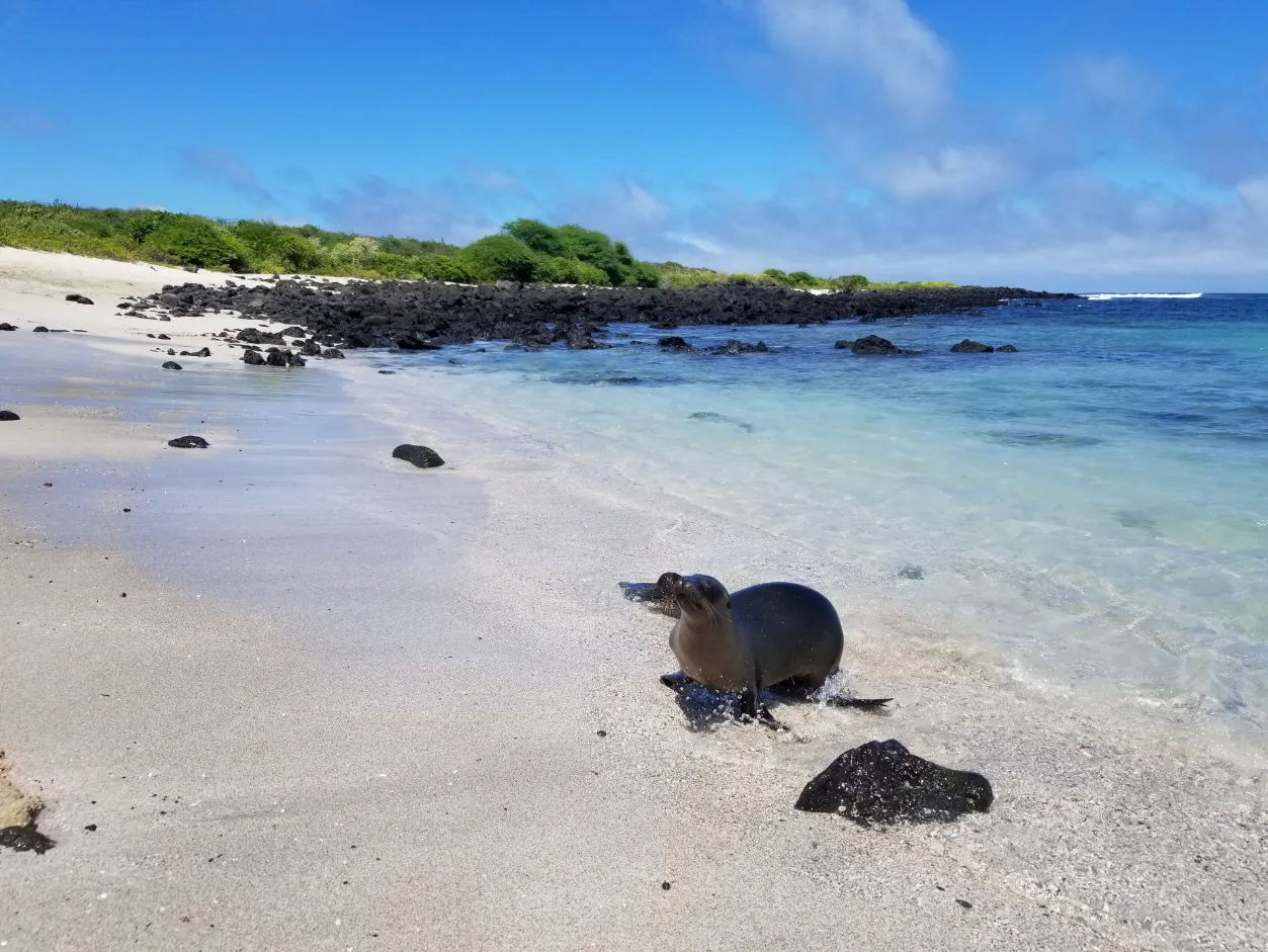
The beach takes its name from Galápagos sea lions that may rest or move between sand, rock, and water, always as wild inhabitants whose space takes priority. Walking, contemplation, photography, and any approach to the sea depend on actual conditions, signage, and available guidance, without promises of wildlife, calm water, access, or activities.
When town begins to open towards the sea
La Lobería is discovered as a change of pace. From the setting of Puerto Baquerizo Moreno, the town does not vanish all at once: it grows more distant, the built edge becomes less continuous, and coastal air begins to shape the route. Arrival may be on foot or by land, but it need not be reduced to an exact route to make sense. What matters is noticing how the landscape makes room for light, wind, and a coast that asks to be read before it is explored.
Along that transition, San Cristóbal seems to rearrange its scale. The urban setting remains behind as a nearby reference while the ocean’s surface gains presence and the land opens out. La Lobería is not a scene apart from the island. It is a place where town, rock, coastal vegetation, and sea meet without erasing their boundaries.
Essential information
- Location
- A coastal area near Puerto Baquerizo Moreno, on southwestern San Cristóbal
- Landscape
- Coral sand, volcanic rock, and a partially sheltered bay or shoreline
- Name
- Associated with Galápagos sea lions
- Activities
- Contemplation, walking, photography, and wildlife observation; a conditional approach to water
- Path
- A possible shoreline route towards rock or cliff
- Infrastructure
- Variable and potentially limited
Coral sand, rock, and a bay that is never the same
Arrival at the beach reveals a contrast that needs no exaggeration. Coral sand opens a pale surface before volcanic rock in darker tones, and the coast can give the impression of a partly contained bay. Yet that outline does not make the sea still. Light, wind, breaking waves, and the movement of water transform the scene throughout the day.
At times the edge may seem to invite silence and attention to the water moving across and away from shore. At others, the energy of the swell becomes more apparent against rock or across the sand. Both readings belong to the same place. La Lobería should not be described as a fixed postcard, but as a coast where appearance and conditions change together.
Contemplation from the sand can be the main experience. Before considering the water, it is worth following the line of breaking waves, noticing the colour of the surface, recognising the position of rocks, and attending to any available signs. Reaching a beach does not require turning it into an activity; staying out of the sea can still reveal its form, scale, and rhythm.
The inhabitants that give the place its name
La Lobería takes its name from Galápagos sea lions that may be present along this coastal edge. They may rest on sand, occupy a rock, or move between shore and water. Their presence is not a landscape service or an invitation to interact: they are wild animals using the place according to their own needs and decisions.
When a sea lion is on the beach, its space takes priority. It is not touched, fed, surrounded, pursued, or blocked. A body, camera, or board should never come between the animal and its route towards sand, rock, or sea. Keeping distance does not diminish the experience; it lets the encounter remain observation rather than interference.
Wildlife does not need to answer a prior idea of closeness. An animal may be far away, move quickly, remain still, or not appear. A responsible visit does not try to produce behaviour or turn the place’s name into a guarantee. It watches carefully, steps back when needed, and lets the coastal edge remain habitat before it becomes a scene.
Reading the sea before asking it for an activity
The bay and rocky sections can suggest different ways of approaching the water, but each possibility depends on the real day. Swell, current, breaking waves, visibility, seabed, entry, and exit change the available margin. No appearance from the sand alone confirms that the sea is suitable for swimming, snorkelling, or another activity.
Swimming may be considered only when conditions, signage, and personal assessment provide an appropriate margin. Water can change during a single stay, and choosing not to enter, shortening an activity, or remaining close to shore does not make the visit less meaningful. Adapting the plan to the sea is care, not a loss of landscape.
Surfing also depends on that reading. The swell that may support an activity for some people requires matching experience, an understanding of breaking waves, and an honest assessment of conditions. It is not presented as a universal practice or a recommendation for beginners. Other people being in the water does not by itself decide what is suitable for anyone else.
Snorkelling near rock, only when the day offers that margin
Snorkelling may be considered near rocky sections or within the bay only when swell, current, breaking waves, visibility, seabed, entry, exit, signage, and available guidance form an appropriate whole. Rock can reveal another scale of the place, but it also calls for more attention: proximity does not replace the margin needed to enter and leave carefully.
Marine iguanas, sea turtles, rays, fish, or sea lions may appear in the water. None is guaranteed, and none justifies pursuing a shape, closing an animal’s route, or moving close enough to turn observation into pressure. Sometimes the value of entering lies in noticing light, relief, and water movement even when wildlife remains out of view.
Masks, fins, and any equipment should be checked before approaching the sea. Equipment does not replace reading conditions or personal capacity. If the day does not provide an appropriate margin, the surface landscape remains complete: sand, rock, wind, and horizon need no immersion to hold depth.
A shoreline path for reading what the beach does not reveal at once
A path may lead from the coastal area along the shore towards rock or cliff. It should not be treated as a fixed itinerary or assumed to be available in every section. Ground conditions, sun exposure, wind, signage, and closures can change how far it is possible to go and how the route is experienced.
Walking along the coastal edge changes the relationship with the beach. Sand remains behind or appears through openings, rock gains weight in the frame, and the ocean is no longer seen only from below. From a higher or more exposed point, the coast may reveal curves, foam, shadow, and shifts in colour, always according to visibility and conditions at the time.
The route becomes richer when it is not forced. Staying on authorised paths avoids damaging fragile vegetation, making new marks in the ground, or approaching sections that need quiet. A closure is not a narrative obstacle to overcome: it is a sign that reshapes the day’s route.
Coastal vegetation, detail, and distance
Around La Lobería, coastal vegetation may appear as shrubs and plants adapted to sea exposure. Its form responds to wind, soil, and the closeness of the ocean. There is no need to turn every section into a botanical list to recognise that this vegetation holds the transitions between path, rock, and beach.
Plants are not touched, removed, or collected. Leaving the route to seek a closer image can affect unobtrusive specimens or leave a trace others repeat. Attention to small things—a short shadow, a leaning branch, a texture beside rock—makes it possible to see the landscape without taking possession of it.
Vegetation also offers a way to measure the change of setting. Near town, the built edge directs the eye; here, land, wind, and plants restore another scale. The coast does not begin only where a street ends: it is made of those details that ask to be crossed more slowly.
Birds and presences that do not follow a script
Frigatebirds, boobies, finches, canario María, and other coastal birds may appear above the shore or around the rocks. Their presence, proximity, and behaviour change. A figure may cross the sky for a moment, remain far over water, or not show itself at all. Observation becomes more honest when it is not turned into a list of species the place must provide.
Responsible photography works with the distance available. A bird is not followed along the path, its rest is not disturbed, and closed sections are not entered for an angle. A partial or distant image may preserve the meaning of the coast more faithfully than an approach that changes the behaviour of one of its inhabitants.
Preparing for an edge with changing services
La Lobería should be approached without assuming toilets, drinking water, food, sufficient shade, lighting, or other services. Infrastructure may be limited or change, so current conditions should be confirmed before arrival. Bringing water, a hat, sun protection compatible with ecosystems, clothing suited to sun and wind, and grip-ready footwear is part of general preparation.
Snorkelling equipment is relevant only when the activity is genuinely being considered and the day provides suitable conditions. Preparation is not a formula that guarantees an experience: it is a way to arrive with more room to observe, pause, or adjust the plan. Heat, wind, ground, and sea should be read in relation to personal capacities.
Two periods, many daily variations
From approximately December to May, the setting is generally warmer and wetter. Heat, rain, insects, light, and the look of vegetation can change how the coast is experienced. From approximately June to November, conditions are generally cooler and drier, with possible wind, garúa, and another reading of the sea.
These are tendencies, not an answer to which period is best or a promise of water conditions, wildlife, views, or activity. Every visit meets a different combination of light, swell, path, and wild life. Arriving ready to adapt the route matters more than pursuing a scene guaranteed by the calendar.
Simple rules for a shared edge
Current signage, closures, and rules take priority over every expectation of continuing along a path, occupying a rock, or entering water. Sand, rock, plants, and other natural elements are not collected. Every piece of waste leaves with the person who brought it, including small fragments the wind can carry towards vegetation or the ocean.
Wildlife needs distance and clear routes. It is not touched, fed, surrounded, or pursued, and sea lions are not blocked between sand, rock, and water. Drones are not used unless current rules and applicable authorisation permit them. Before bringing one, current requirements must be checked; an exception should never be assumed.
Frequently asked questions
- It is a coastal area near Puerto Baquerizo Moreno, on southwestern San Cristóbal, known for coral sand, rocks, its partially sheltered bay or shoreline, and the possible presence of Galápagos sea lions.
- The name is associated with Galápagos sea lions that may use the sand, rocks, and water. No additional etymology is added, and their presence is not presented as guaranteed.
- No. They are wild animals and may appear, remain out of view, or move through the setting. When present, their space and routes take priority.
- Keep distance and do not touch, feed, surround, pursue, or block their passage between sand, rock, and water.
- No. Swell, current, breaking waves, visibility, seabed, entry, and exit change. The bay’s appearance does not guarantee calm, clarity, or safety.
- Swimming may be considered only when actual conditions, signage, available guidance, and personal capacities provide an appropriate margin.
- It may be considered near rocky sections or the bay only when swell, current, breaking waves, visibility, seabed, entry, exit, and available guidance allow it.
- Marine iguanas, sea turtles, rays, fish, or sea lions may appear. No species or encounter is guaranteed.
- No. It depends on swell, breaking waves, conditions, and each person’s experience; it is not presented as a universal activity for beginners.
- A shoreline route towards rock or cliff may exist. Only authorised routes and current signage should be followed; no length is fixed and constant availability is not guaranteed.
- Frigatebirds, boobies, finches, canario María, and other coastal birds may be present. Species, numbers, proximity, nests, and behaviour are not guaranteed.
- Toilets, drinking water, food, shade, lighting, and other services should not be assumed. Infrastructure can change, so current conditions should be confirmed.
- Water, a hat, sun protection compatible with ecosystems, clothing suited to sun and wind, and grip-ready footwear. Snorkelling equipment applies only if that activity is being considered and conditions allow it.
- Only if current rules and applicable authorisation permit it. Requirements should be checked before use.
The return: when coast begins speaking with town again
On the way back, La Lobería reassembles in reverse. The beach recedes, rock loses scale, the path returns attention to plants and shadows, and Puerto Baquerizo Moreno appears again as a reference. The return does not erase the coast: it shows that town and marine edge were nearby parts of the same island.
Memory may hold pale sand before dark rock, the movement of a sea lion at a distance, a bird above the horizon, or the sound of breaking waves against the edge. None of it needs to happen as a promise. La Lobería leaves a more precise experience when it is visited as a living place: with room for the sea, for wildlife, and for changing the plan.