Places
Beaches, lagoons, viewpoints and visitor sites across the Galápagos: what to see and what to expect, from Tortuga Bay to Kicker Rock.
Island
Española Island
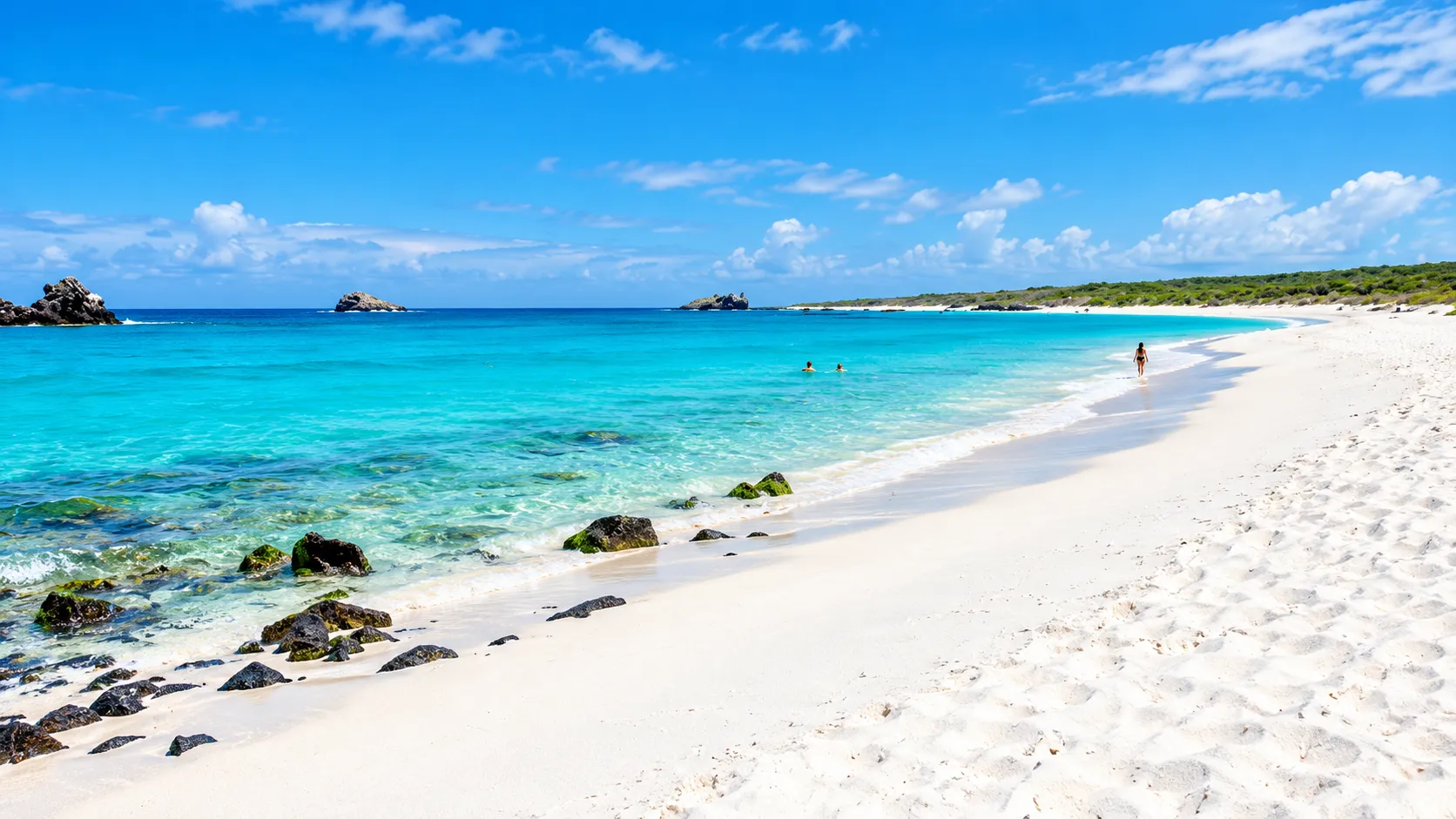
Gardner Bay
Gardner Bay, on the coast of Española island, is an extensive white-sand beach bordered by shallow turquoise water. The visit arrives by sea, with a wet landing directly on the sand, and runs without inland trails: the day stays on the beach, among sea lions resting in the sun, a curious mockingbird that approaches without fear, and finches working the vegetation along the shore. On the rocks, marine iguanas bask and Sally Lightfoot crabs move about, and in the clear water green turtles swim. Off the sand, a small semi-submerged islet appears, a tuff cone whose surroundings are the usual setting for snorkelling at the site. It is, above all, a place to stay: to look, to walk barefoot, and to share, with respect, the beach the sea lions chose for resting.
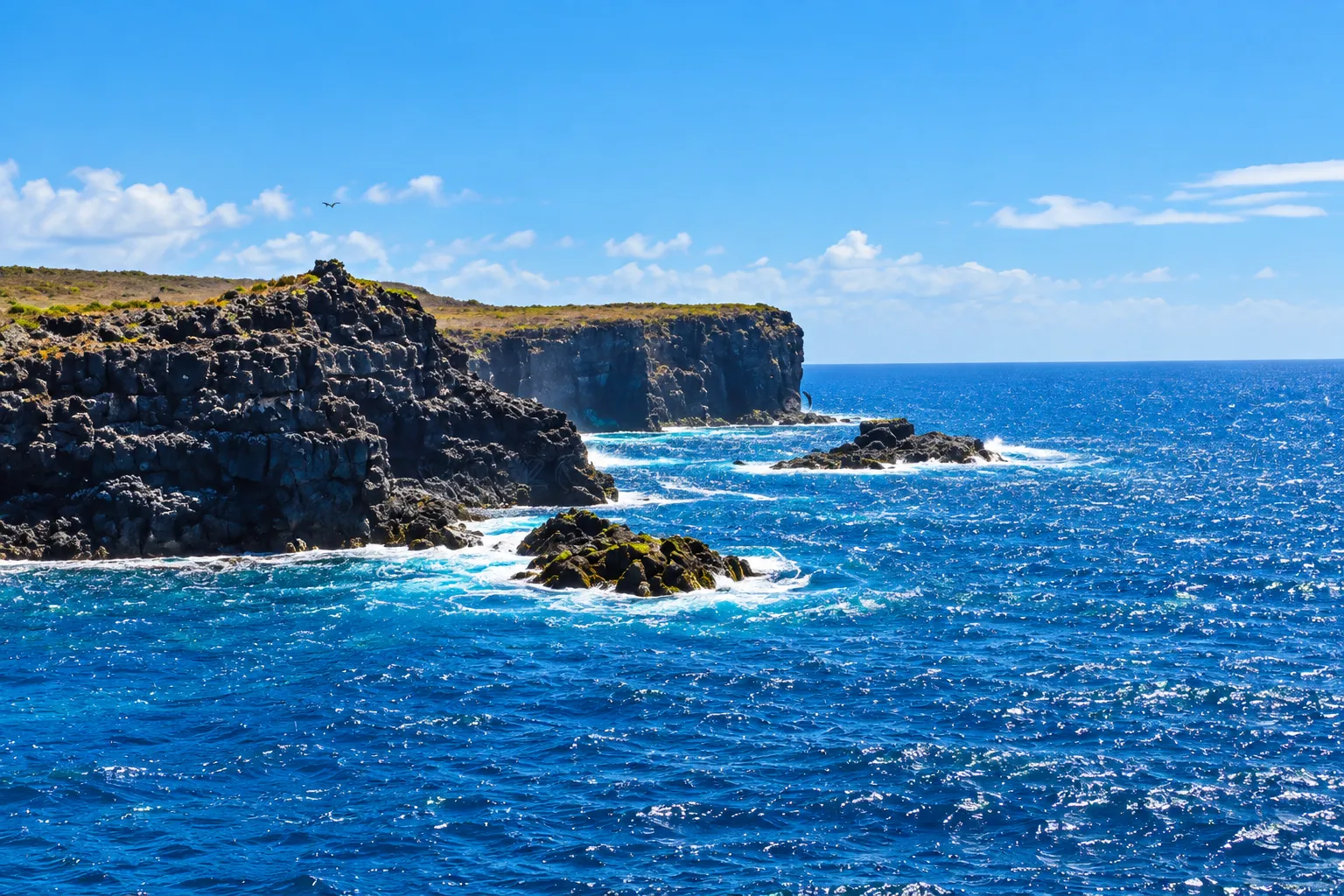
Punta Suárez
Punta Suárez, at the west end of Española island, is walked as a sequence of scenes. The visit begins with a dry landing on dark lava rock, beside a small lighthouse. A circular trail then works along the shore, crosses a labyrinth of rounded volcanic rocks through arid vegetation, and reaches a plateau where the waved albatross uses the cliff edge as a takeoff point. The high coast offers panoramic overlooks over the sea and the Soplador, where waves shoot water skyward through a fissure in the lava. On the descent, the nesting areas of Nazca boobies and blue-footed boobies accompany the return to the lighthouse.
Island
Fernandina Island
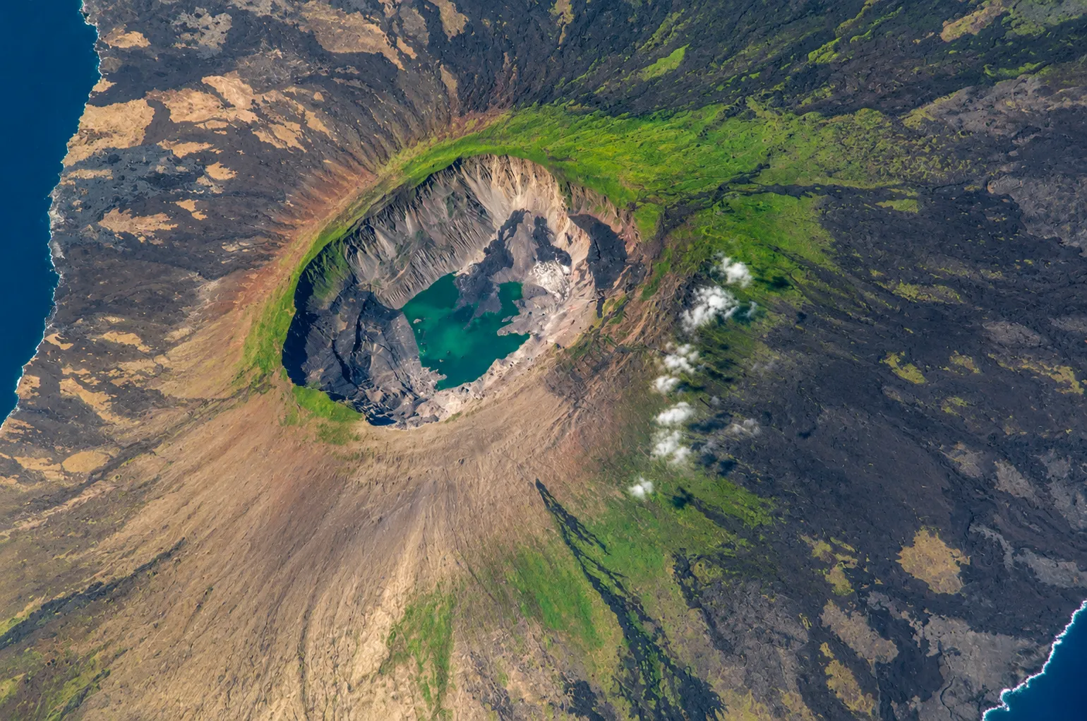
La Cumbre Volcano
La Cumbre Volcano rises on Fernandina island, an uninhabited territory on the western edge of the archipelago and the youngest island in the archipelago, and figures among the most active volcanoes of the archipelago. Its shield shape, with broad gentle slopes, comes from eruptions of very fluid lava and crowns in a broad caldera whose floor has known collapses. Its eruptions are effusive, basaltic in character: the accumulated magma opens its way through flank fissures, the lava travels down the slopes and, when it reaches the sea, adds new land to the coast in a landscape that never stops renewing itself. The visit does not reach the volcano: it is admired from the sea and from the surroundings, where Punta Espinoza, the neighbouring site on Fernandina's coast, shares the same young-lava island. On the coasts and slopes live, as a possibility, marine and land iguanas, Galápagos penguins, flightless cormorants, blue-footed boobies, sea turtles, and sea lions.
Island
Floreana Island
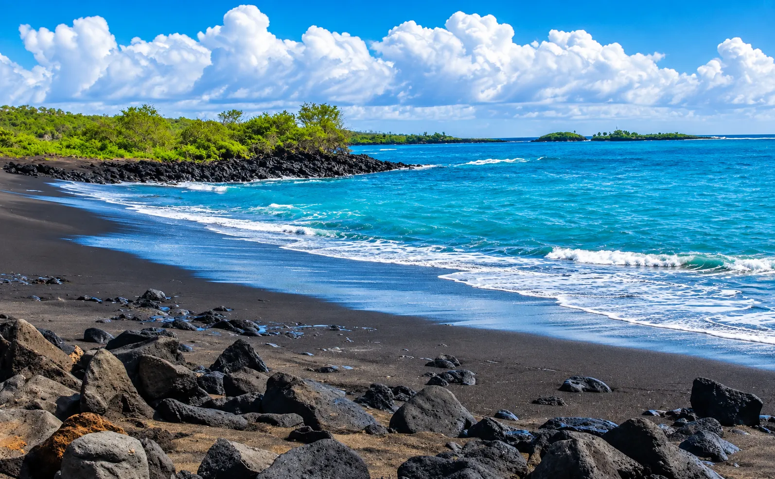
Black Beach
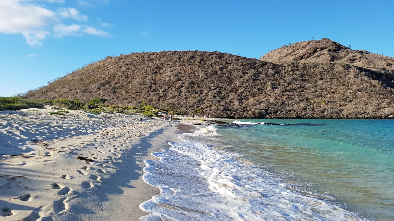
Black Beach is the landing beach of Floreana island, on the shore where Puerto Velasco Ibarra, the port town, stands. Its dark volcanic sand contrasts with the clear water of the bay, and around the beach rocky formations shelter rich underwater life. Sea lions rest on the sand and marine iguanas endemic to Galápagos walk along it; in the water, green turtles, rays, and fish may appear, while pelicans, frigatebirds, and blue-footed boobies fly over the coast. When the sea allows it, the bay offers the possibility of snorkelling among the rocky bottoms. The beach is also part of the island's memory: the first settlers are said to have come ashore here, drawn by the fresh water of the nearby highlands.
Punta Cormorant
Punta Cormorant, at the northern tip of Floreana island, brings together on a short walk two beaches that seem to come from different worlds. The visit begins on a beach of greenish sand, tinted by olivine crystals of volcanic origin. Behind it lies a brackish lagoon where flamingos sift the bottom for tiny shrimp, joined by white-cheeked pintails, stilts, and shorebirds. The trail then climbs a low slope among palo santo trees and comes down to Flour Beach, whose white coral sand is so fine it feels like powder. Green turtles nest there, and rays glide through the shallow water. It is also one of the places in Galápagos with the greatest diversity of plants, some of them endemic to this part of Floreana.
Post Office Bay
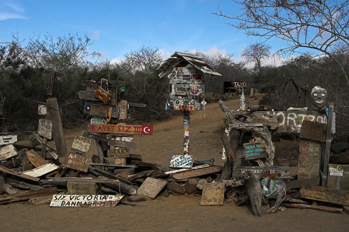
Post Office Bay, on the north coast of Floreana island, is one of the few visitor sites in Galápagos where human history takes centre stage. In the late eighteenth century, the whalers who sailed the Pacific left a wooden barrel here that worked as a post office: each sailor dropped off letters with the address written on them, and ships heading home collected the ones they could deliver. The tradition is still alive. Visitors leave their own postcards in the barrel, look through the ones waiting there, and take those they can deliver by hand. A short distance away there is a lava tube entered by a ladder. On the beach and in the water of the bay, sea lions, green turtles, and rays may appear, and among the vegetation, Darwin's finches, yellow warblers, and lava lizards, always as a possibility.
La Lobería of Floreana
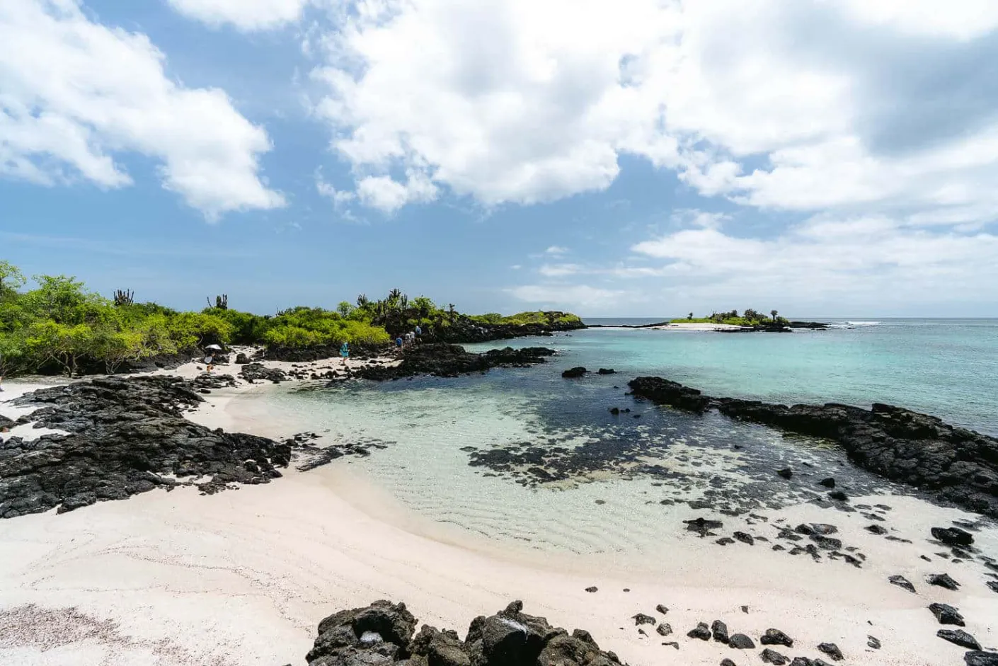
La Lobería is a coastal visitor site on Floreana island, south of Puerto Velasco Ibarra. It is a point of dark volcanic rock with white-sand beaches and arid vegetation at its tip, beside a bay with rocky floors. A sandy-bottomed water inlet runs across it, and at high tide the point is cut off from the rest of the island. It is reached on foot along a coastal trail, over sand and rock, that leaves town and looks out over the bay. Its name comes from the Galápagos sea lions that rest on the sand and swim in the bay. Marine iguanas may be seen on the rocky shore, and in the water, green turtles, rays, and fish, always as a possibility. It is also a spot where Floreana's residents come to spend the day by the sea.
Island
Isabela Island
Cerro Azul Volcano
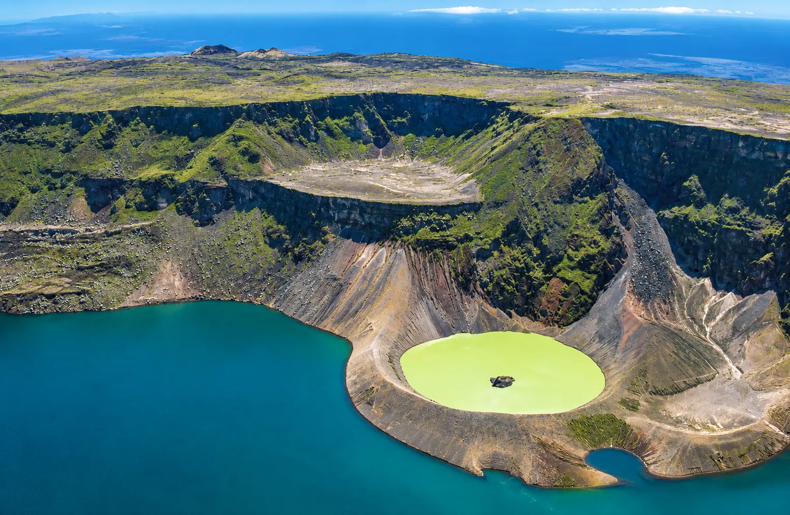
Cerro Azul Volcano rises at the far southwestern end of Isabela island, southwest of Sierra Negra, and is one of the most active volcanoes of the archipelago. Its broad, gentle slopes climb to a broad summit caldera, in a great dark dome moulded by solidified lava flows and cinder cones. The effusive eruptions of this basaltic volcano have poured lava from the caldera and from fissures on its flanks, and the young lava fields contrast with the mountain's older structure. The visit does not reach the volcano: it is admired from the designated trails of the nearby sites and from the sea, where the neighbouring landscape of Punta Moreno shares the same volcanic belt. On the slopes live, as ecological context, the giant tortoise, the land iguanas, and the lava lizards, and the waters of the west coast, fed by a cold, deep current, sustain abundant marine life.
Sierra Negra Volcano
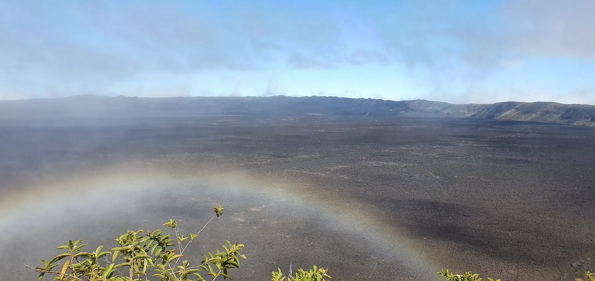
Sierra Negra Volcano, on Isabela island, is one of the six shield volcanoes whose lava flows merged to form the island. Its name refers to the dark colours of the old lava fields, and its broad caldera, with a shallow floor, figures among the largest calderas in the world. The visit climbs from the island's highlands to the rim of the caldera, which is walked with open views over the interior, where young flows appear as dark patches against the lighter terrain. On the volcano's flank, the Volcán Chico area shows landscapes of young lava almost without vegetation and fumaroles that reveal the volcanic activity of the site. On clear days, the view reaches other volcanoes of Isabela and Fernandina island, while the highlands sustain finches, mockingbirds, and, as ecological context, the giant tortoise.
Arnaldo Tupiza Tortoise Breeding Centre
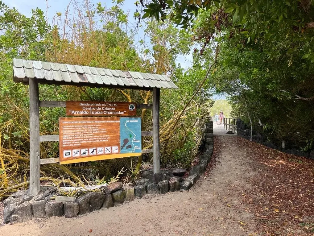
The Arnaldo Tupiza Tortoise Breeding Centre, on the outskirts of Puerto Villamil on Isabela island, is where the Galápagos National Park authority breeds and rears in captivity the giant tortoises of the south of the island: the Sierra Negra tortoise, Chelonoidis guntheri, and the Cerro Azul tortoise, Chelonoidis vicina. Eggs are incubated at the centre, hatchlings grow in pens under conditions similar to the wild during their first years, the most vulnerable ones, and the young tortoises later return to the volcanoes they come from. Tortoises of all ages, from hatchlings to breeding adults, can be seen in the pens. It is reached on foot by an interpretive trail that leaves Puerto Villamil and crosses wetlands, lagoons, and dry forest, where flamingos, waterbirds, and marine iguanas may appear, always as a possibility.
Wall of Tears
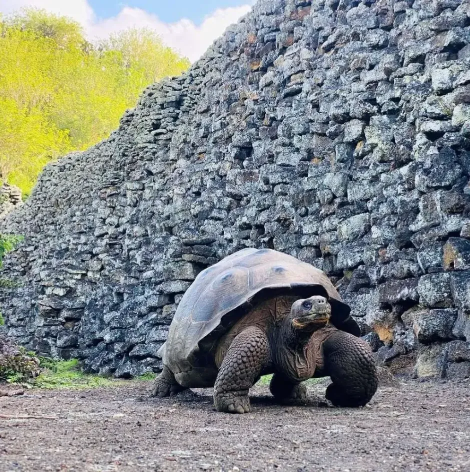
The Wall of Tears is a historical site on Isabela island, west of Puerto Villamil. It is a long wall of lava blocks that the prisoners of the Isabela penal colony raised by hand in the mid-twentieth century, with no purpose other than keeping them busy in exhausting forced labour that cost lives. Today it is a place of memory that recalls a period of cruelty in the human history of the archipelago. It is reached by a trail that leaves Puerto Villamil, passes the town cemetery, crosses the southern Isabela wetlands, with white-sand beaches, lagoons, and mangroves, and continues through the dry zone to the wall. Steps climb to the Cerro Radar viewpoint, with a wide view of the coast. Along the way, giant tortoises, marine iguanas, shorebirds, and Darwin's finches may appear, always as a possibility.
Pearl Shell
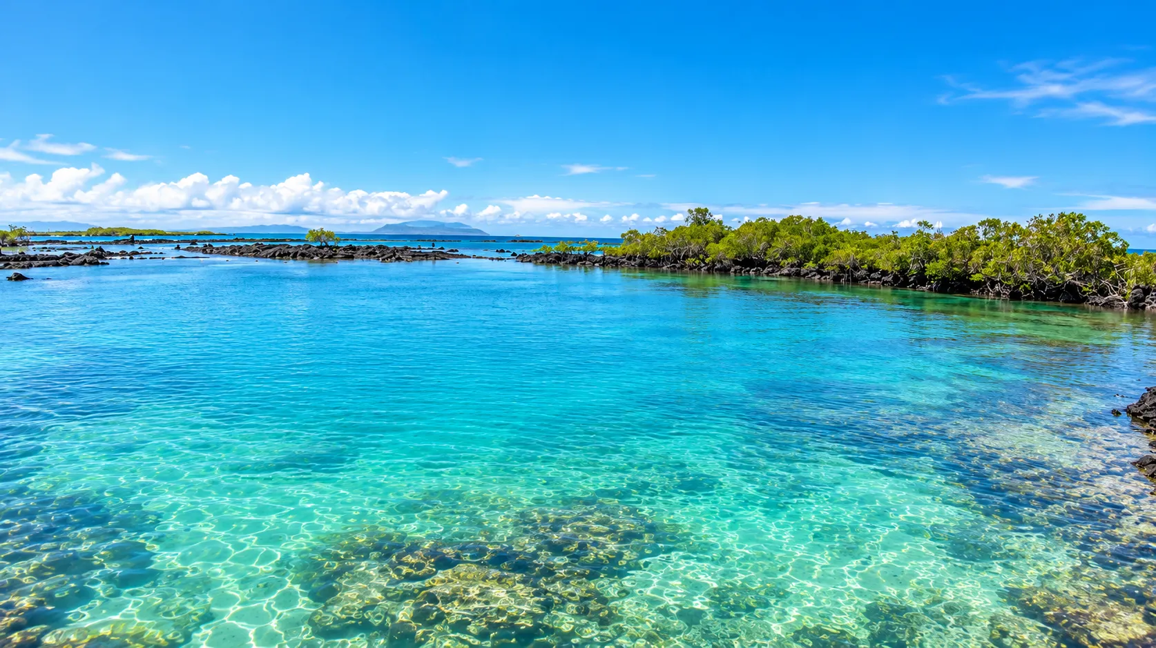
Pearl Shell is a small lagoon of calm, clear saltwater next to the Puerto Villamil dock, on Isabela island. Volcanic rock formations shelter it from the open sea, and red, black, white, and button mangroves surround it. It is reached on foot along a wooden boardwalk that crosses the mangroves and ends at a small platform from which visitors enter the water. Snorkelling and swimming are the activities of the place. Galápagos sea lions, sea turtles, marine iguanas, tropical fish, rays, and Galápagos penguins may appear in the lagoon or on the platform, always as a possibility. The marine iguana is endemic to Galápagos, and the tortuga prieta is the archipelago's green turtle. The visit takes place within the protected area: not touching or disturbing the animals and keeping a distance is the expected conduct.
Island
San Cristóbal Island
Playa Mann
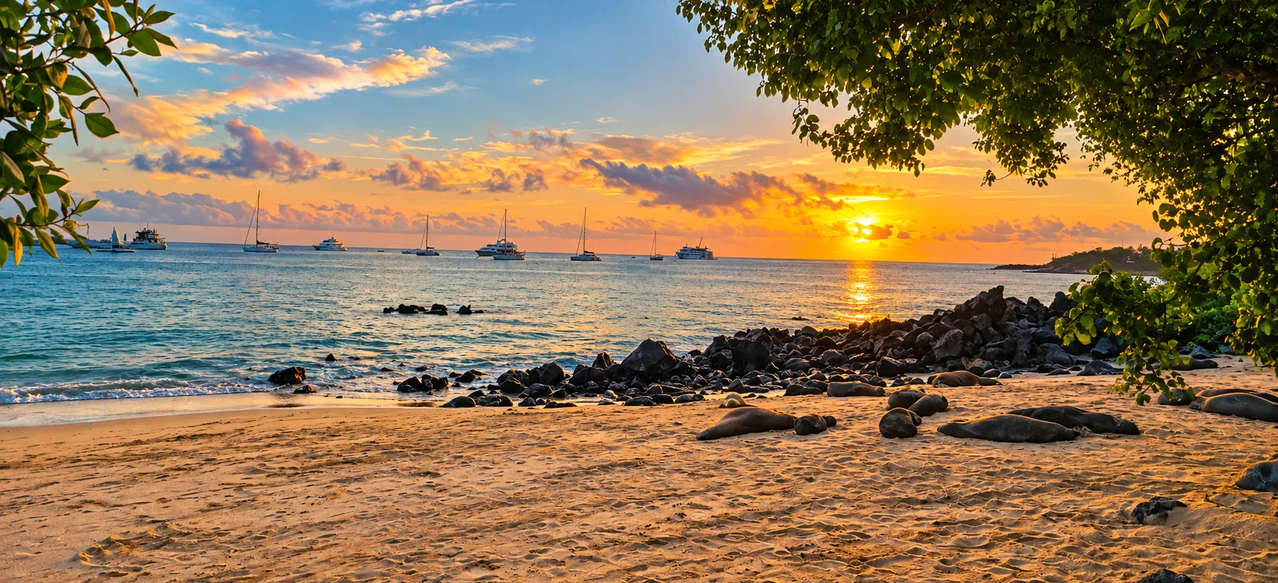
Playa Mann is a small urban beach on the northern edge of Puerto Baquerizo Moreno, on San Cristóbal island, in front of the Universidad San Francisco campus that hosts the Centro de Ciencias Galápagos. It is reached on foot from the town centre, and its white sand, formed by shell fragmentation, slopes gently down to water that can turn clear and allow snorkelling and swimming, always depending on sea conditions. Kayaking appears as a possibility when surf and current allow it. The shore's west-facing orientation makes it favourable to sunsets and photography, as a tendency and never as a promise. Sea lions may rest on the rocks or the sand and swim near visitors: their presence is a possibility that is met with distance, without touching them, without feeding them, and never blocking their route. Marine iguanas, frigatebirds, boobies, Galápagos gulls, Sally Lightfoot crabs, sea turtles, and, occasionally, dolphins complete the possible wildlife of the surroundings. A food area with small kiosks, bathrooms, and a lifeguard tower are among the site's reported services, all to be confirmed on the ground. From the town's edge, trails connect the area with neighbouring sites of the island, as context of the coastal landscape and not as a closed itinerary.
Opuntia Garden
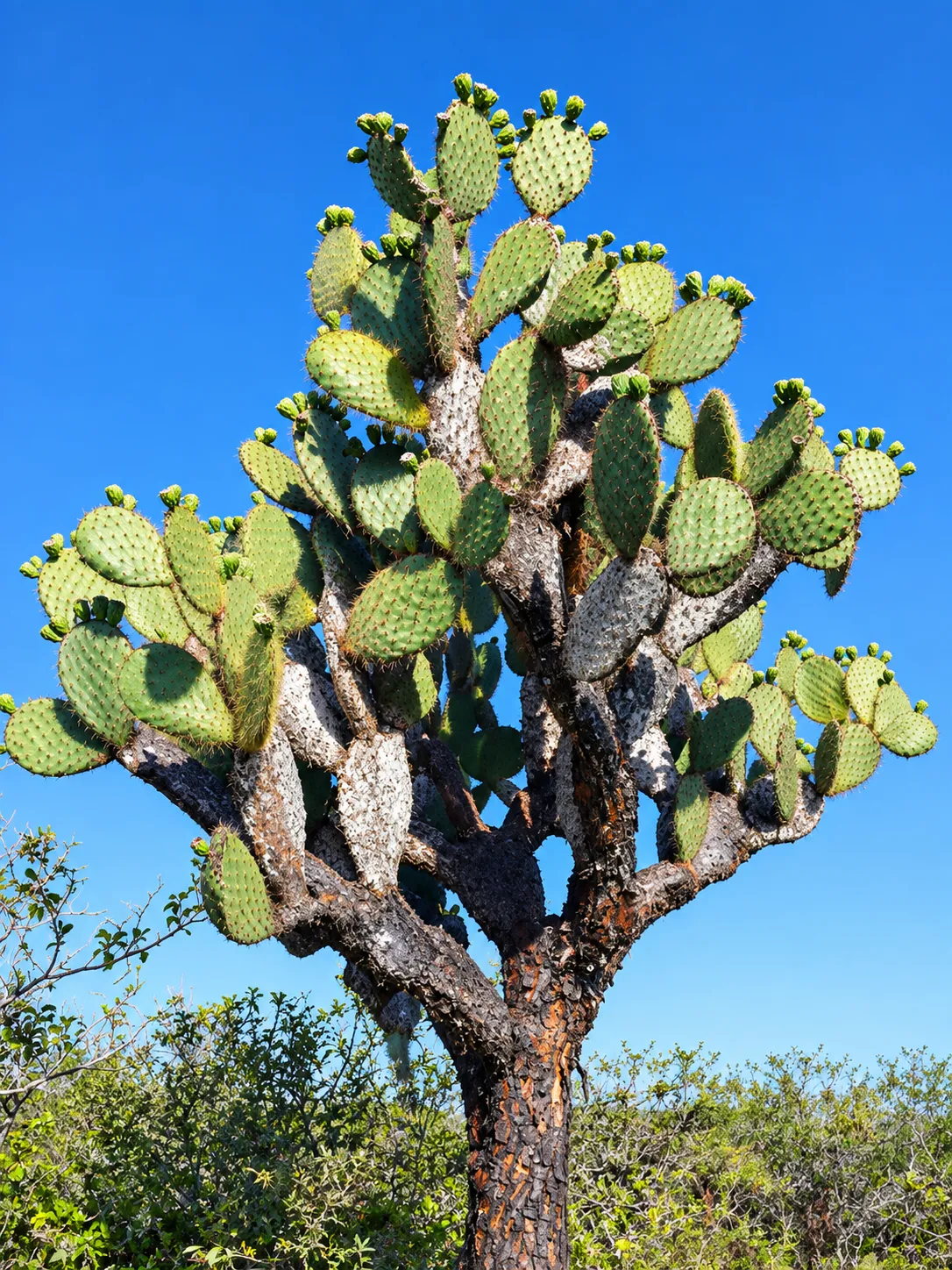
Opuntia Garden is a coastal site in the arid south of San Cristóbal island, where the material describes giant cacti of the Opuntia genus as the leading feature of the landscape. Galápagos hosts endemic prickly-pear cactus species of the Opuntia genus, and the surrounding plants include palo santo, muyuyo, button mangrove, and manzanillo, a tree with toxic sap whose leaves and fruit must not be touched. The site is usually covered on foot, by a trail that descends from the island's southern agricultural area towards the coast. The site meets the shore at a beach the material cites as Playa de Veinte Varas, where snorkelling appears as a possibility, and with areas that can flood seasonally, a feature of the landscape rather than a fixed condition. Wildlife is presented as a possibility and never as a guarantee: the San Cristóbal mockingbird (Mimus melanotis), a bird found on this island, and Darwin's finches are among the possible presences, and walking and botanical interpretation are the activities with which the place is explored.
Rosa Blanca Bay
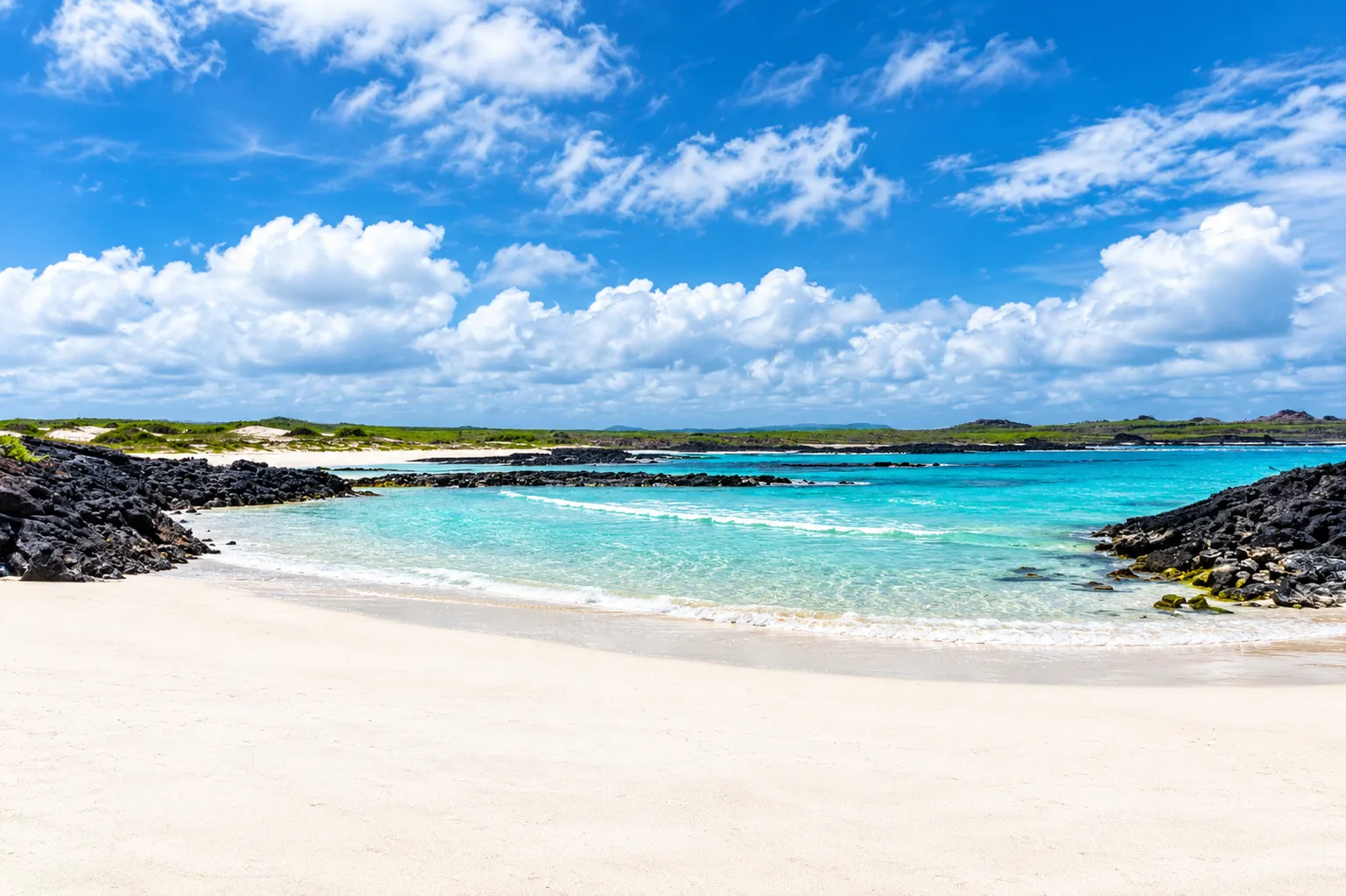
Rosa Blanca Bay is a visitor site of the protected area on the east coast of San Cristóbal island. It is a bay with several small beaches: at its centre lies a larger beach with fine white sand and clear, turquoise-toned water, and the surroundings combine mangroves, dunes, and small lagoons in a volcanic landscape with cacti of the Opuntia genus. It is usually reached by sea from Puerto Baquerizo Moreno, on a nautical tour. The site includes a pyroclastic cone reached by a short signposted trail documented by the protected-area management authority, and it has snorkel and walking zones used under its management. The bay's waters are part of the marine reserve, a coastal-marine environment studied in biodiversity baseline work. Snorkelling and swimming are among the possible activities, and marine life is always presented as a possibility and never as a guarantee: sharks, rays, and sea turtles may appear in the water. The Galápagos green turtle, Chelonia mydas agassizii, is known in Spanish as tortuga prieta, and Galápagos hosts endemic prickly-pear cactus species of the Opuntia genus.
Baquerizo Beach
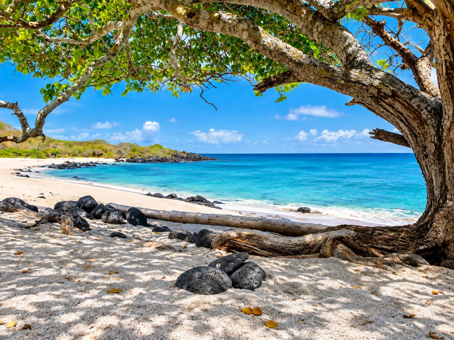
Baquerizo Beach is a visitor site of the protected-area management authority, on the slopes of Cerro Tijeretas, on San Cristóbal island. It is a small, secluded cove that coinciding versions describe with white sand and clear, turquoise-toned water. It is usually reached on foot by a trail that crosses the Cerro Tijeretas area, over uneven volcanic terrain, with climbs and descents and among vegetation. Hiking and swimming are among the activities the site is used for, and snorkelling and birdwatching appear as possibilities, within the framework of a visit to a protected area. The surrounding wildlife is presented as a possibility and never as a guarantee: frigatebirds, Darwin's finches, marine iguanas, sea lions, sea turtles, herons, lava lizards, and hermit crabs are among the possible presences of the trail and the cove. The marine iguana is endemic to Galápagos, the Galápagos sea lion is part of the island's coastal fauna, and the frigatebirds present in the archipelago include the magnificent frigatebird and the great frigatebird. The protected-area management authority recorded the site among the island's visitor sites, and maintaining the access trail is part of its park rangers' documented work.
Ochoa Beach
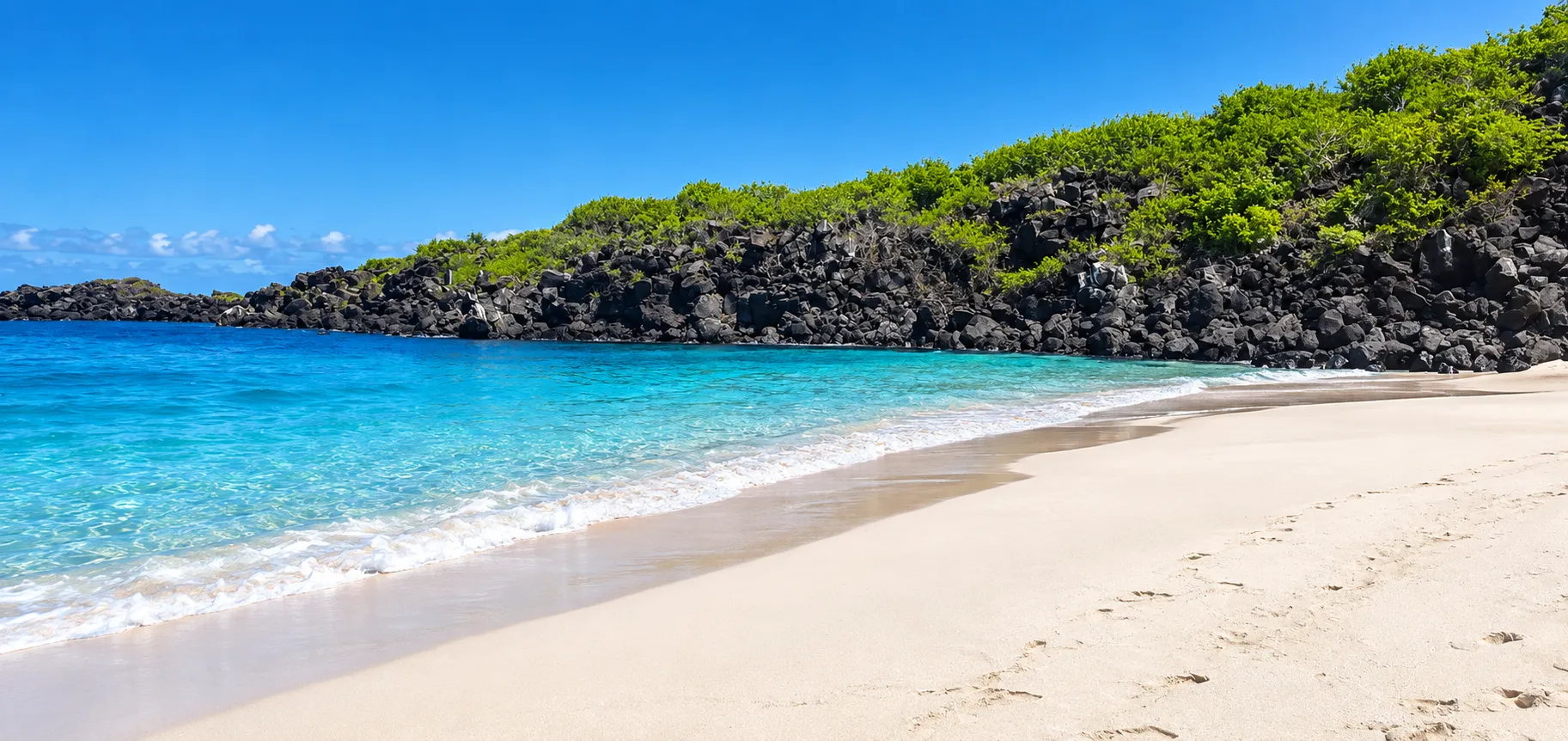
Ochoa Beach is a white-sand beach with calm waters on the north coast of San Cristóbal island. It is usually reached by sea from Puerto Baquerizo Moreno, with a landing on the beach itself. Behind the sand there is a seasonal pool or lagoon that is part of the coastal setting and offers habitat for shorebirds and migratory birds, including blue-footed boobies, frigatebirds, gulls, and pelicans. The Galápagos sea lion is part of the area's coastal fauna, where visits take place under the protected-area management authority and keeping a distance from wildlife is expected conduct. The San Cristóbal mockingbird, endemic to the island, is part of the surrounding fauna, and ghost crabs and hermit crabs may be seen on the sand. The matazarno appears as a representative plant species of the place. Swimming and snorkelling are possible activities, and rays, sea turtles, sea lions, and fish may appear in the water, always as a possibility and never as a guarantee. The protected-area management authority has recorded the beach among the San Cristóbal sites visited with park rangers during an environmental education activity about the island's ecosystems.
El Progreso
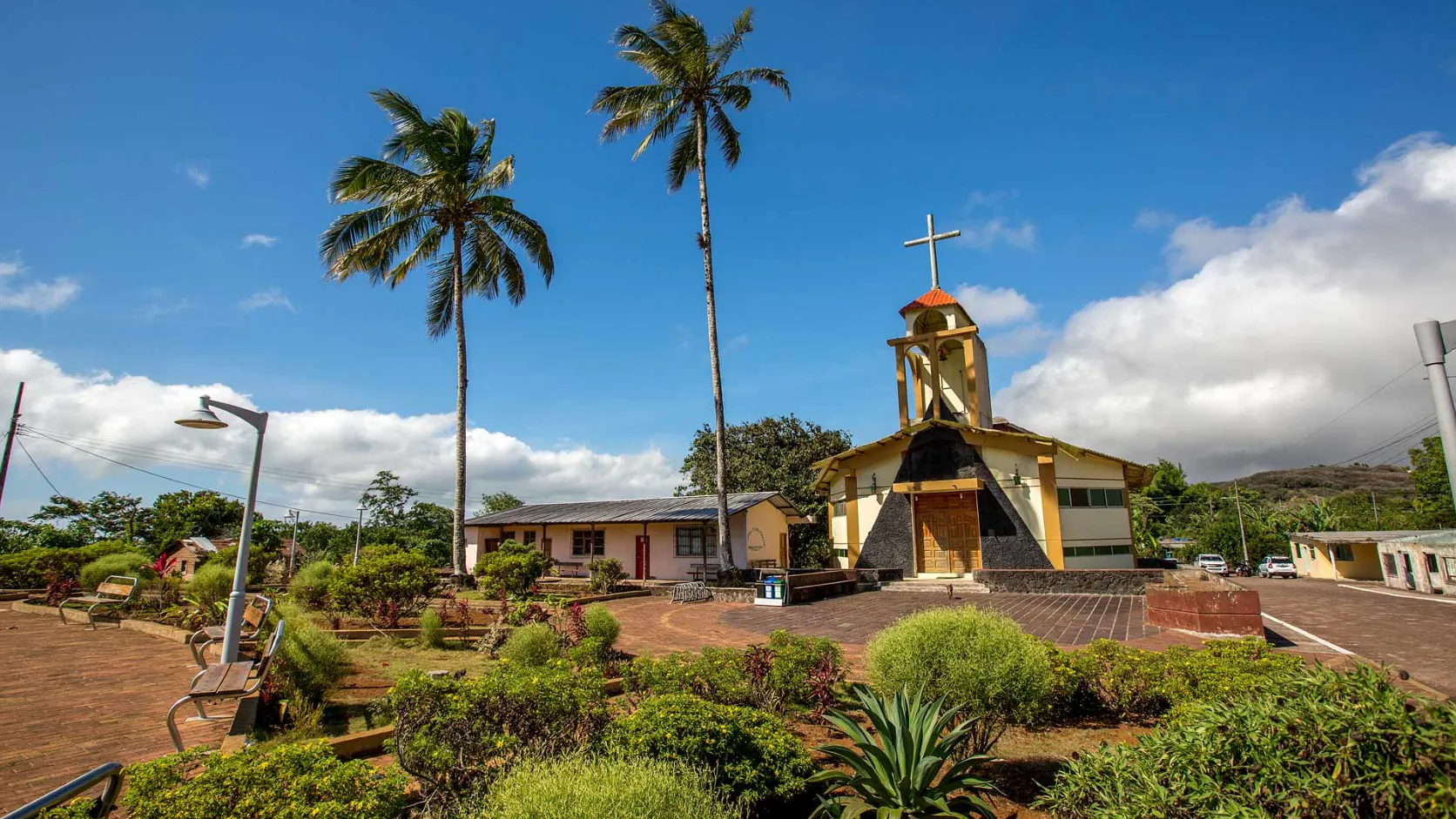
El Progreso is associated with San Cristóbal, inland from the setting of Puerto Baquerizo Moreno, and is consistently described as the island's first permanent human settlement. The place is historically associated with a late nineteenth-century agro-industrial hacienda founded by Manuel J. Cobos, dedicated to growing and processing sugar cane, whose ruins can be observed today. That period ended in 1904 with a documented episode of violence, which is remembered soberly as part of the site's memory, without becoming its dominant feature. The landscape changes vegetation with altitude relative to the coast and may include epiphytic flora and terrestrial fauna depending on actual conditions. Demographic, administrative, historical production, and specific tourist figures are unconfirmed and require editorial verification before publication.
Gianni Arismendy San Cristóbal Environmental Interpretation Center
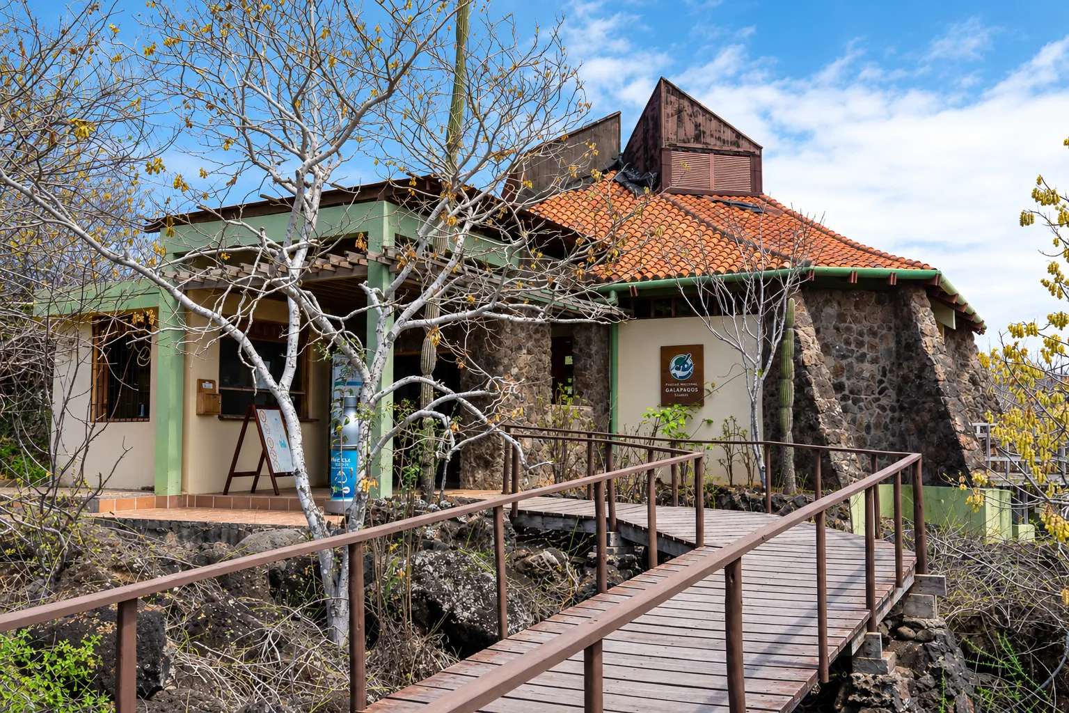
The Interpretation Centre is associated with San Cristóbal, in the setting of Puerto Baquerizo Moreno, and is presented as a Galápagos National Park visitor site organised into thematic rooms that would address natural history, human history, and conservation or development. Access would be described through a pedestrian trail connecting it with Punta Carola and Cerro Tijeretas, and the complex might include outdoor spaces or an open-air projection area. The project's origin is consistently associated with Spanish cooperation coordinated with the Galápagos National Park Directorate. Construction year, opening hours, whether admission is free, exact distances, and other specific details are unconfirmed and require editorial verification before publication.
La Galapaguera
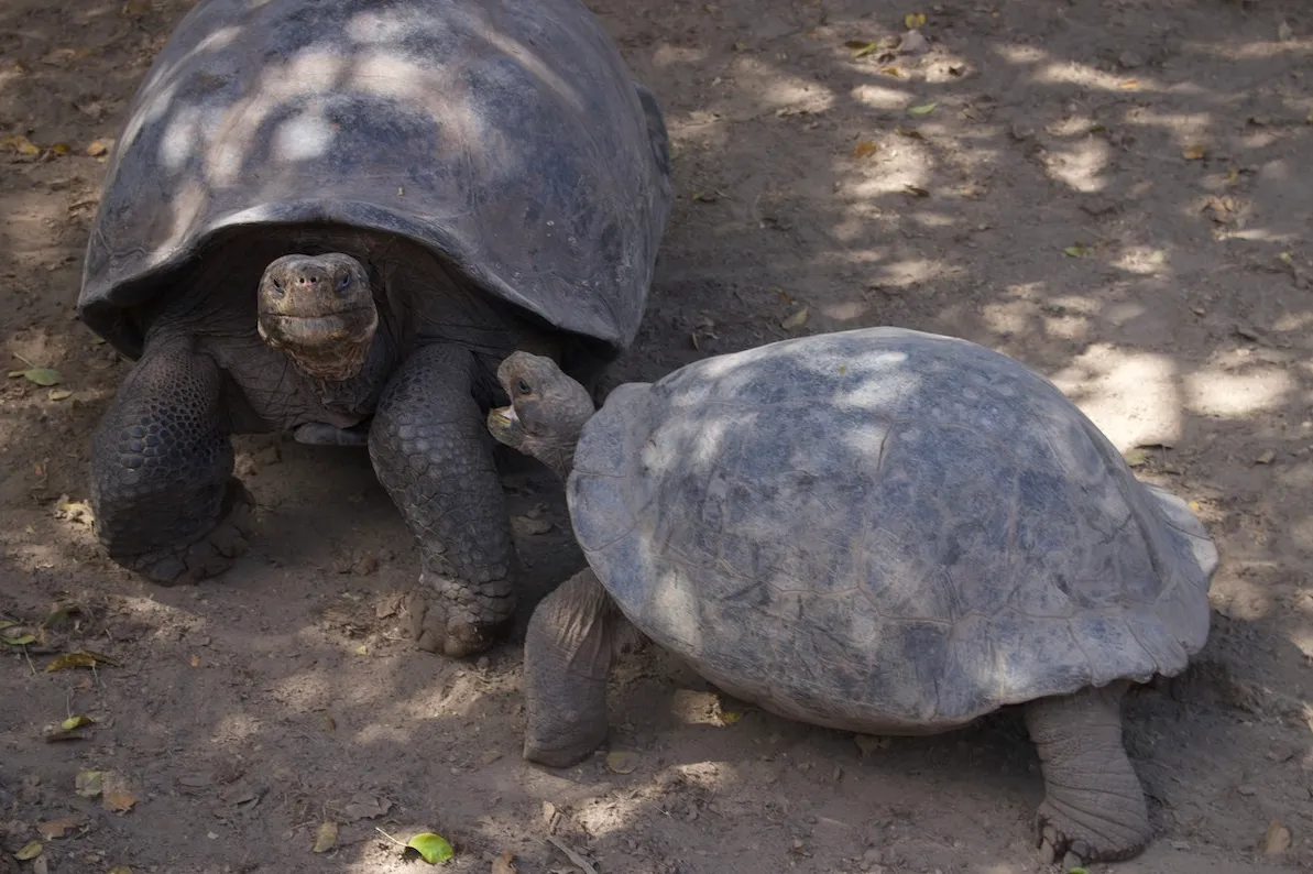
La Galapaguera, also referred to as Cerro Colorado, is associated with San Cristóbal and is presented as a space for giant tortoise breeding or conservation. A visit may invite respectful observation at a distance and, depending on current circumstances, recognition of giant tortoises, management processes, learning, or interpretation without turning any of them into certainties. The route, animal presence, vegetation, access, and any interpretive space depend on current signage, closures, conditions, and guidance; encountering the site without demanding outcomes helps distinguish conservation from spectacle.
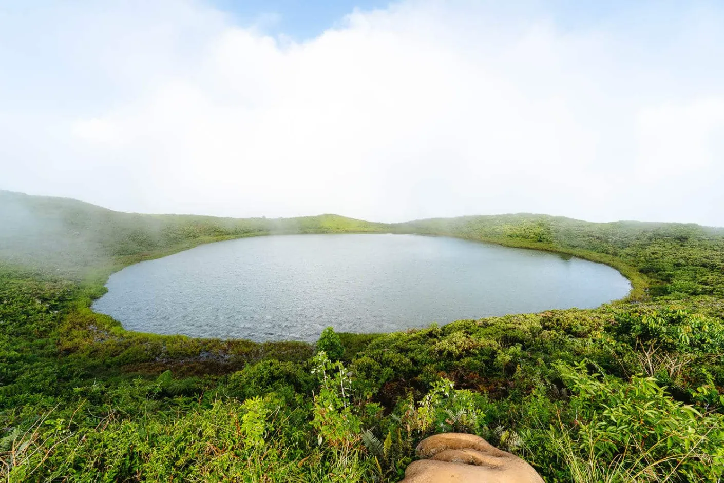
Laguna El Junco
Laguna El Junco, also known as El Junco, is a freshwater lagoon or reservoir in the highlands of San Cristóbal, contained within a crater of extinct volcanic origin. Fed by rain, it offers a change of setting from the coast: cooler air, humidity, clouds, or fog that may shift during a visit. Water, visibility, birds, access, and the route depend on actual conditions, signage, closures, and path status; observing without promising outcomes is a respectful way to encounter the place.
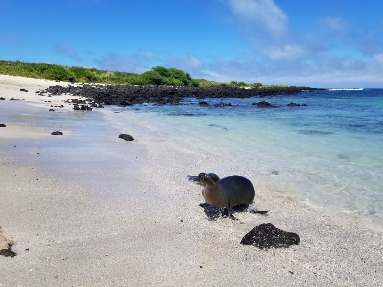
La Lobería
La Lobería is a coastal area near Puerto Baquerizo Moreno, on southwestern San Cristóbal, where coral sand, volcanic rock, and a partially sheltered bay or shoreline create a changing edge between town and ocean. The beach takes its name from Galápagos sea lions that may rest or move between sand, rock, and water, always as wild inhabitants whose space takes priority. Walking, contemplation, photography, and any approach to the sea depend on actual conditions, signage, and available guidance, without promises of wildlife, calm water, access, or activities.
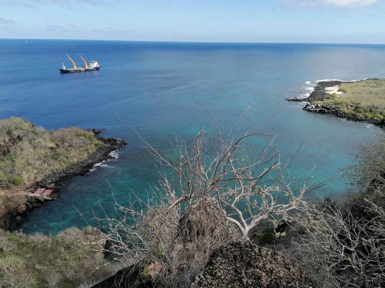
Cerro Tijeretas
Cerro Tijeretas links Puerto Baquerizo Moreno with a coastal circuit on San Cristóbal, where the Interpretation Centre, lava paths, cacti, transition vegetation, and Tijeretas cove form a walking sequence of discovery. As the route rises, views may open towards the town, coast, and marine horizon, while frigatebirds recall the hill’s local name through their forked tails. The experience invites walking and observation, with any approach to the water considered only when actual conditions, signage, and available guidance allow it—without promises of views, wildlife, services, or permanent access.
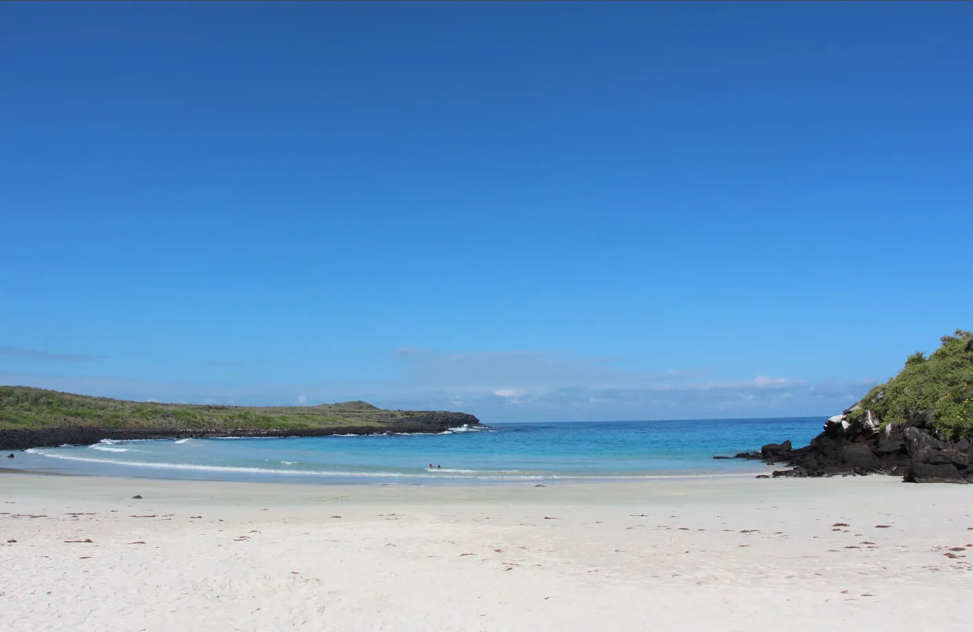
Puerto Chino
Puerto Chino is a fine white-sand cove at the end of the road that crosses San Cristóbal from Puerto Baquerizo Moreno through El Progreso and the highlands. A short path passes through arid-zone vegetation before revealing a beach framed by dark volcanic rock, where the water may take on turquoise tones as light and conditions change. Contemplation, walking, photography, and responsible observation share the setting with in-water activities that should only be considered after reading the actual sea that day, without promises of calm, access, or wildlife.
Kicker Rock
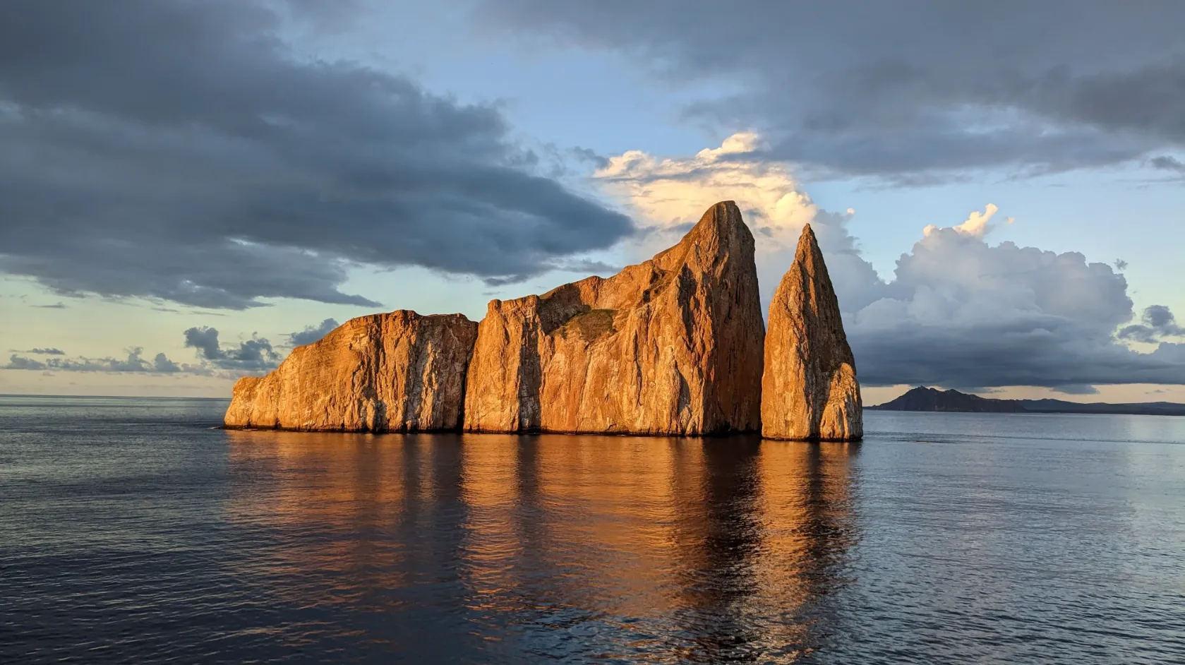
Kicker Rock, also known as León Dormido, rises off the coast of San Cristóbal as two immense walls of volcanic tuff divided by a natural channel. The sea has shaped a profile that may resemble a sleeping lion from one viewpoint and a boot from another, while the rock continues below the surface into a dynamic marine setting. The experience unfolds from a boat and, when conditions and the guide’s assessment allow, through responsible snorkelling or diving, always with honest expectations of wildlife that remains entirely wild and never guaranteed.
Island
Santa Cruz Island
Las Bachas
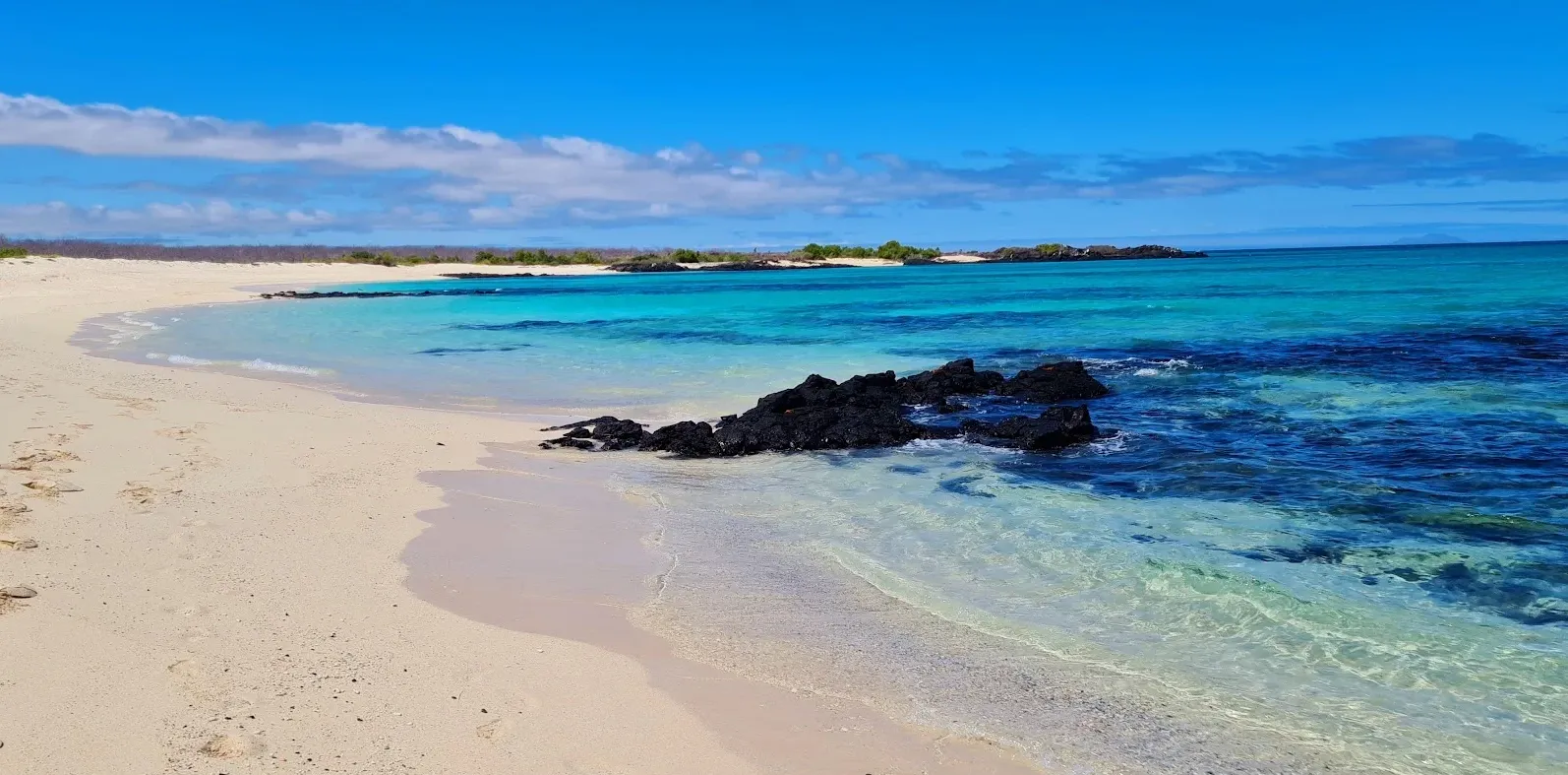
Las Bachas are two white coral-sand beaches on the northern coast of Santa Cruz island, west of the Itabaca Channel and near Baltra, reached only by sea. Their water tends to be calm and shallow, sheltered from the open sea, and can offer gentle swimming and an easy first snorkel, always depending on conditions. The site is an important nesting ground for the archipelago's green sea turtle, and that area is walked with respect, without touching nests or tracks. Behind the sand, a brackish lagoon may host American flamingos and wading birds, possible presences that vary with the water level and are never guaranteed. Marine iguanas rest on the rocks at the edges, and Sally Lightfoot crabs and hermit crabs roam the shore. The mangroves around the lagoon and the arid-zone vegetation behind the beaches complete the landscape. The name comes from the barges abandoned by United States forces after the Second World War, whose local pronunciation became "bachas"; remnants of those vessels are reported as still visible in places, depending on conditions. Access is only possible by boat with authorized guides, with a wet landing, and the park's rules apply in full.
El Garrapatero
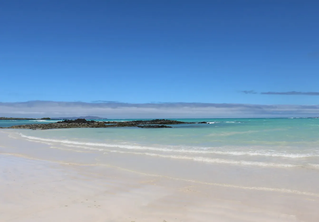
El Garrapatero is a beach on the east coast of Santa Cruz, in the island's rural area, far from Puerto Ayora and away from any settlement. It opens onto a wide bay and is fringed by mangroves. It is reached from the rural highlands passing through the Bellavista area and, from the car park, along a pedestrian trail that crosses the arid zone, among Opuntia cacti, palo santo, and poison apple trees, with Galápagos finches and lava lizards as possible companions along the way; a maritime access route is also mentioned. Behind the beach lies a mangrove-fringed lagoon where flamingos and wading birds such as herons, stilts, oystercatchers, and white-cheeked pintails may appear, always as a possibility and never as a guarantee. Along the shore and in the sea, marine iguanas, sea lions, Sally Lightfoot crabs and ghost crabs, blue-footed boobies, frigatebirds, sea turtles, and reef fish may appear. Swimming, snorkelling, kayaking, birdwatching, and walking are possible activities of the site; camping belongs solely to the protected-area rule and is possible only with Galápagos National Park authorisation. The beach is also used by the local community as a recreation site, without this entry asserting anything about how many people visit it. Sand colour, beach length, lagoon water type, times, distances, prices, schedules, climate data, guide requirements, and visitor numbers present documentary divergences, are not resolved by inference, and are not asserted in this entry. The site's description rests on material provided without URLs, consistent across versions, and pending editorial verification.
Playa de los Alemanes
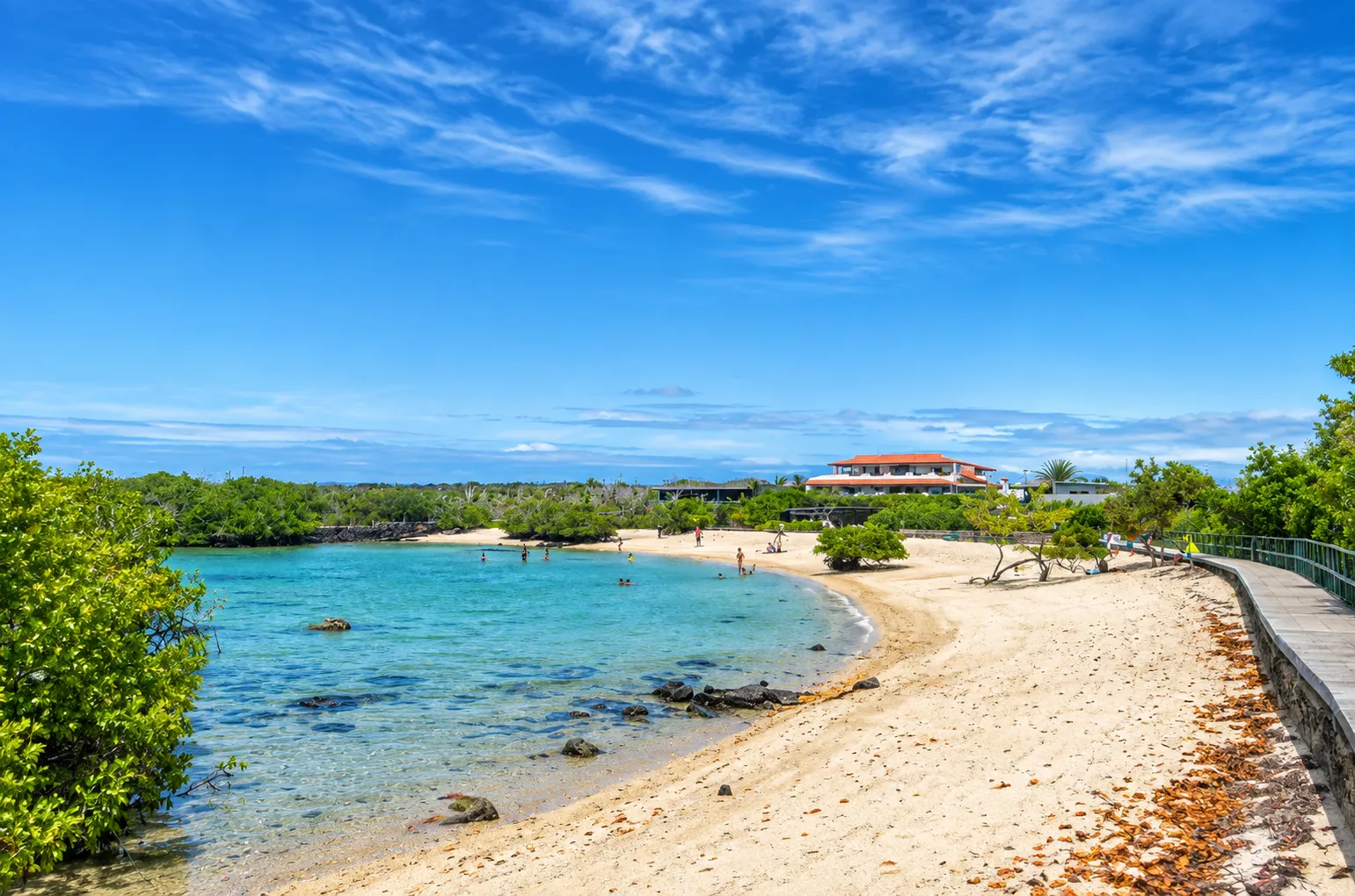
Playa de los Alemanes is a small, sheltered cove on Santa Cruz island, in the Punta Estrada sector, within the Academy Bay area, on the way towards Las Grietas and reachable from Puerto Ayora. Its waters are usually described as calm and clear, and the small bay is flanked by mangroves. Behind the beach there are brackish lagoons or pools that the access trail crosses, and the vegetation combines mangroves and salt-tolerant plants along the shore with palo santo and prickly pear in the nearby arid interior. Shorebirds and Sally Lightfoot crabs may be seen on the rocks. The institutional documentation consulted records that marine iguanas nest in the coastal zone and that the protected-area management authority has installed signage to protect their nests, with this beach among the places identified for that signage following community initiatives; that work is carried out annually in coastal areas near the populated ports, so this entry presents it as documented practice and a rule of conduct rather than as the site's current state. The documented rule is to identify and respect that signage, to avoid entering the marked-off zones, and to avoid stepping nearby, so as not to disturb the reproduction process. Swimming and snorkelling are possible, and fish, rays, and occasionally sea turtles may appear, always as a possibility and never as a guarantee. As elsewhere in the protected area, no sand, coral, or shells are removed. Access is usually described in general terms through a water taxi from the Puerto Ayora dock and a short walk along a trail, and arrival on foot or by bicycle is also mentioned. The site's physical description rests on consistent non-institutional material and remains pending editorial verification. Sand colour, visitor numbers, times, distances, prices, the recommended moment according to the tide, schedules, climate data, and the origin of the name present documentary divergences, are not resolved by inference, and are not asserted in this entry.
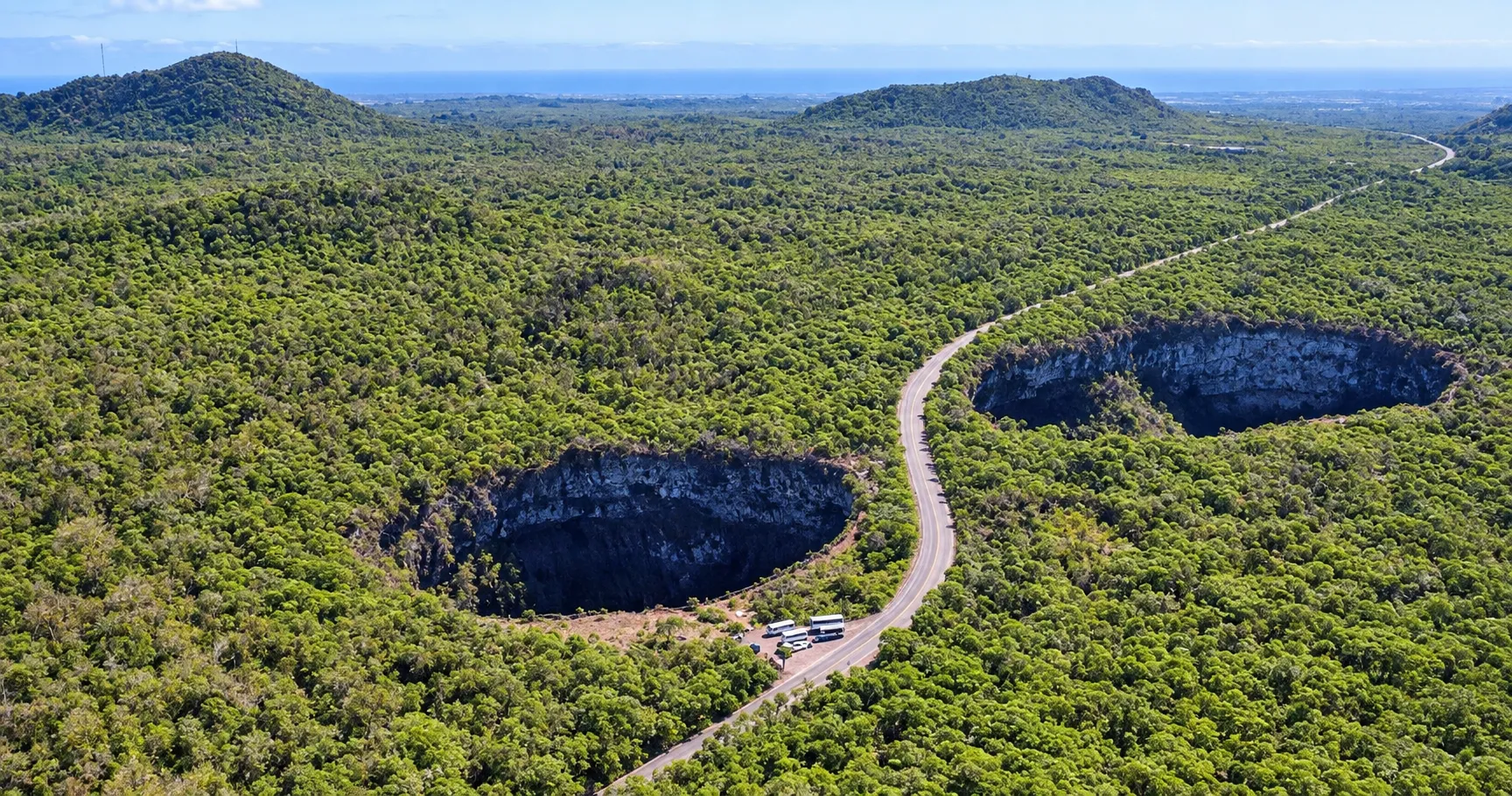
Los Gemelos
Los Gemelos are two large depressions in the Santa Cruz highlands, one on each side of the road that crosses the highlands towards the north of the island, and that facing arrangement, split by the road, explains the site's name. The institutional sources consulted describe them as sinkholes or collapse pit craters rather than eruptive craters: they formed through the collapse of the surface over subterranean cavities or chambers that had been emptied out. Both depressions are surrounded by Scalesia forest, dominated by the endemic tree Scalesia pedunculata, known as the tree daisy or daisy tree, and the Scalesia zone is a humid highland forest beneath whose canopy mosses, bromeliads, epiphytes, and orchids thrive. The area is recognised as one of the best-known places to observe Scalesia forest in Santa Cruz. This species grows in cohorts of similar age and height, so entire populations may die and regenerate together within a natural cycle of renewal, and El Niño events, droughts, and floods can collapse whole forests. The forest at the site has been severely affected by the historical change in agricultural land use and by introduced plants and animals, among them the invasive blackberry Rubus niveus, which grows vigorously in the highlands, prevents the recruitment of native seedlings, and can turn a species-rich forest into scrub. There is a documented history of blackberry control and of forest restoration with nursery-grown seedlings, accompanied by scientific monitoring of vegetation, invertebrates, and birds; that history describes a process, not an outcome or a current state. The forest is important for numerous invertebrates, for Darwin's finches, and for two flycatcher species, and the documentation reviewed records a decline of the vermilion flycatcher population in Santa Cruz, without that asserting presence, absence, or guaranteed observation at the site. Access is usually along the highland road from Puerto Ayora, by taxi, land transport, or bicycle, often combined with other visits in the highlands. Depth, diameter, altitude, distances, times, schedules, costs, species counts, and the forest's current state remain pending editorial verification and are not asserted in this entry.
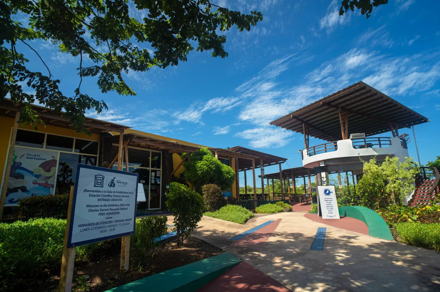
Charles Darwin Research Station
The Charles Darwin Research Station (CDRS) is the headquarters of the Charles Darwin Foundation in Puerto Ayora, Santa Cruz, opened in 1964 as a base for scientific research in Galapagos. Entry is free and the campus receives visitors every day from 8am to 6pm, including holidays. The public route includes the Charles Darwin Exhibition Hall, the Van Straelen Interpretation Center with its "Marine World" theme on sharks and marine pollution, the Native Gardens and Shade House with endemic flora such as Scalesia affinis, and the G. T. Corley Smith Library, Archive, and Museum. As the largest scientific station in Galapagos, it is a strategic ally for researchers, welcoming 95 visiting scientists from 17 countries in 2022. Behind those areas, the institution holds a natural history collection of more than 135,000 specimens, sustains an Inspiration Complex with research laboratories, and maintains the dataZone, an open platform with more than 60 years of scientific data on the archipelago. The campus also keeps the memory of Lonesome George, the last known giant tortoise of his subspecies, who lived at the nearby Breeding Center until his death in 2012, without achieving reproduction despite the breeding programme's attempts.
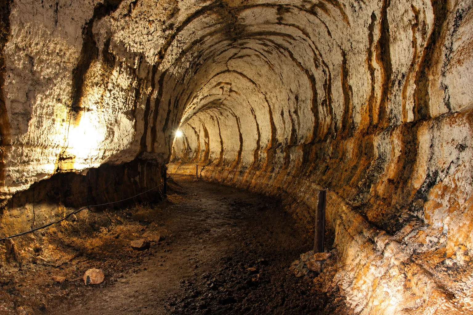
Lava Tunnels
Lava Tunnels is a reference associated with Santa Cruz to geological formations of the highlands, present at several locations in the Bellavista and Santa Rosa areas, with at least one additional site mentioned near the road to Baltra. They form when the surface of a lava flow cools and solidifies on contact with the air while the fluid material keeps running underneath; once the eruption ends and the interior empties out, a hollow tube remains, whose roof may partially collapse from cooling, fissures, or seismic activity, exposing its interior. Walking through it means moving along an underground space with a floor of volcanic rock, and some stretches may require bending down or crawling. Lighting varies by tunnel: some have artificial light installed and others depend on a torch. Access is usually by taxi, tourist transport, or bicycle from Puerto Ayora, often combined with other highland visits, and there may be fauna adapted to the darkness, always as a possibility conditional on actual conditions at the time. Length, schedules, cost, and whether a guide is required may vary and are worth confirming locally before a visit.
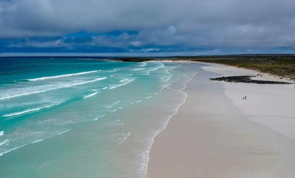
Tortuga Bay
Tortuga Bay is a place associated with Santa Cruz, southwest or south of Puerto Ayora, reached by a pedestrian trail from town that crosses an area of arid vegetation with Opuntia cactus and palo santo. The beach is consistently divided into two sectors: Playa Brava, with strong surf and currents where swimming is not permitted, and Playa Mansa, more protected and calm, connected to the previous one by a stretch of beach or a short path through mangroves, where swimming, snorkelling, and kayaking are possible. There may be marine iguanas, sea turtles, coastal birds, and Sally Lightfoot crabs, always as a possibility conditional on actual conditions at the time, including possible seasonal turtle nesting in the dunes. Access is subject to registration at a Galápagos National Park post at the start of the trail, and there are no services such as food, water, restrooms, or umbrellas on the beach. Whether a guide is required, exact schedules, walking distance and time, observable shark species, the presence of flamingos, and the exact nesting date may vary and are worth confirming locally before a visit.
Laguna de las Ninfas
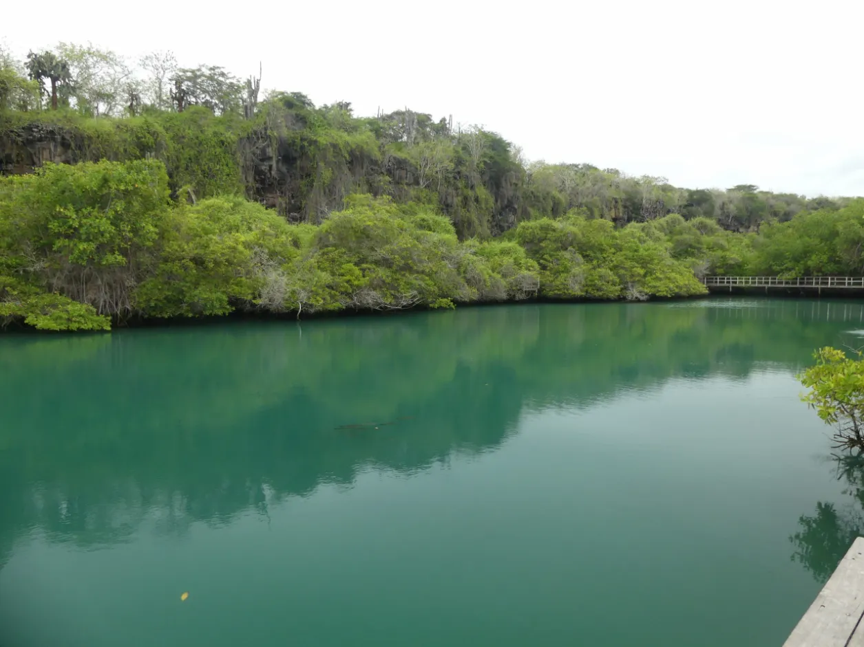
Laguna de las Ninfas is a place associated with Santa Cruz, located in the urban area of Puerto Ayora, in the neighbourhood that gives it its name. It is a brackish-water lagoon formed by the mix of seawater, which enters with the tide, and fresh water filtered from land; salinity varies with the state of the tide. It is surrounded by mangrove, with a consistent presence of white mangrove and red mangrove. The walk follows a wooden walkway with information panels, and the place is meant for contemplation and observation: swimming and water activities such as kayaking are not allowed. There may be birds and aquatic fauna present, always as a possibility subject to actual conditions at the time. The exact number of mangrove species, the lagoon's dimensions, walking distances and lengths, and specific climate figures are not confirmed unanimously across sources and require editorial verification before publication.
Las Grietas
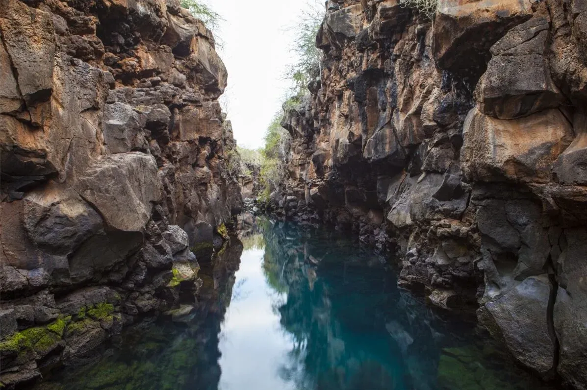
Las Grietas is a place associated with Santa Cruz, in the setting of Punta Estrada, across Academy Bay from Puerto Ayora. It is a volcanic geological formation: lava fissures forming tall walls, with brackish water — a mix of filtered fresh water and seawater — forming chained natural pools. Access combines a water-taxi crossing from Puerto Ayora and a subsequent walk along a volcanic rock and dirt trail that passes salt-water pools and lagoons and coastal vegetation. The place may attract visitors wishing to swim, snorkel, or free-dive, and to observe landscape, flora, and fauna, always subject to Galápagos National Park rules and to variable conditions and capacity. Access costs, whether a guide is required, schedules, and exact figures for distance, depth, or temperature are not confirmed unanimously across sources and require editorial verification before publication.