The site is an important nesting ground for the archipelago's green sea turtle, and that area is walked with respect, without touching nests or tracks. Behind the sand, a brackish lagoon may host American flamingos and wading birds, possible presences that vary with the water level and are never guaranteed. Marine iguanas rest on the rocks at the edges, and Sally Lightfoot crabs and hermit crabs roam the shore. The mangroves around the lagoon and the arid-zone vegetation behind the beaches complete the landscape. The name comes from the barges abandoned by United States forces after the Second World War, whose local pronunciation became "bachas"; remnants of those vessels are reported as still visible in places, depending on conditions. Access is only possible by boat with authorized guides, with a wet landing, and the park's rules apply in full.
Two coral-sand beaches on the northern coast of Santa Cruz
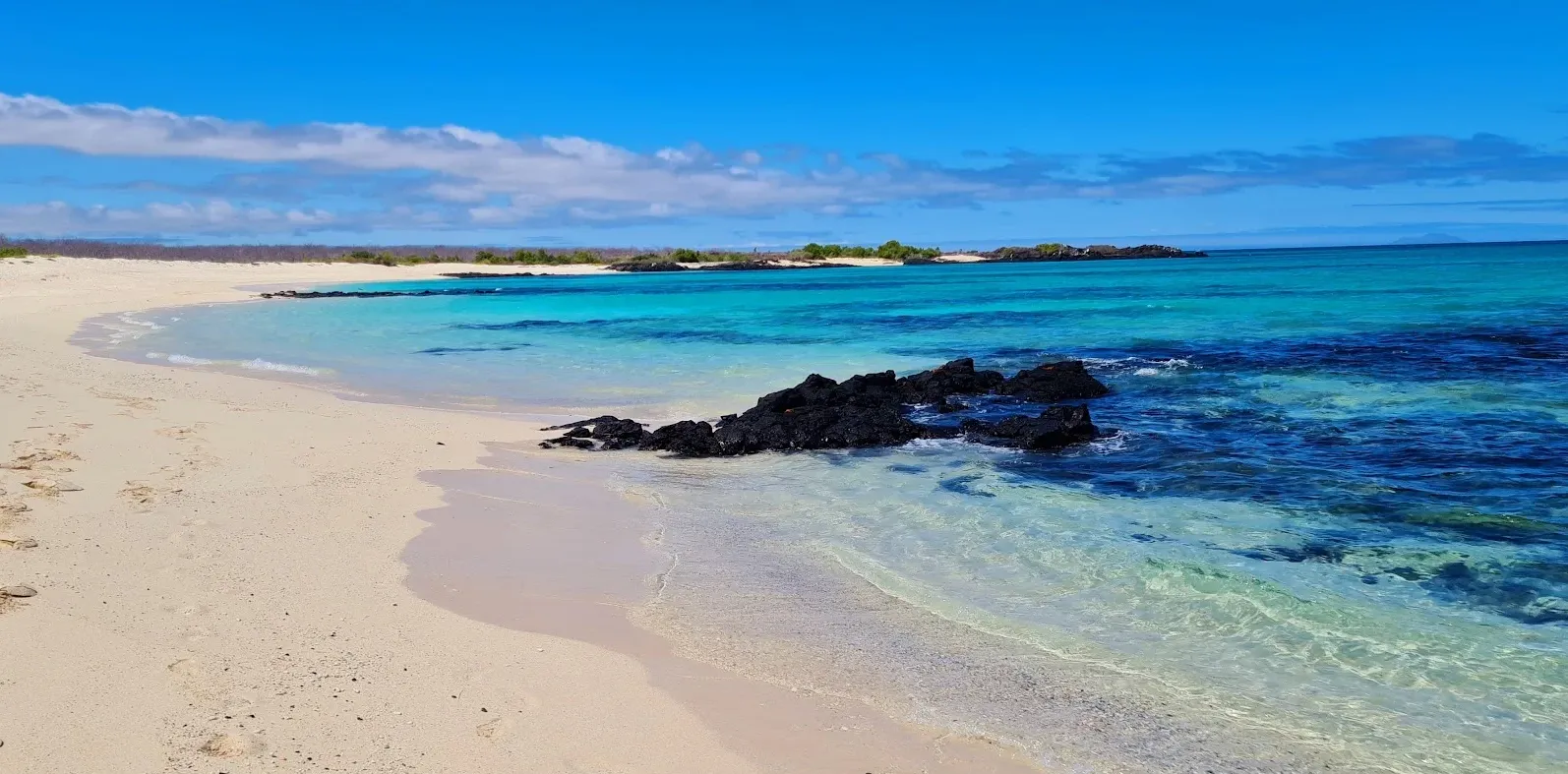
Las Bachas are two white coral-sand beaches on the northern coast of Santa Cruz island, west of the Itabaca Channel, facing Baltra. The site is visited from the sea: there is no road or public trail of land access, and that marine condition defines the place's character. The two beaches are documented as a single contiguous visitor site, and the national park rules that govern the archipelago apply to the whole shore.
The sand and the shore
The sand is white and coral in origin, fine and light, and the two beaches extend continuously along the same coast. That coral sand is the shore's consistent character; rocks appear at the edges where marine iguanas rest, a condition that accompanies the site's outline without defining it.
Essential information
- Location
- Northern coast of Santa Cruz island, west of the Itabaca Channel, near Baltra
- Beaches
- Two contiguous white coral-sand beaches on the same shore
- Sand
- White coral-origin sand, fine and light
- Water and activities
- Calm, shallow water that can allow swimming and an easy first snorkel, always depending on conditions
- Nesting
- Nesting ground of the archipelago's green sea turtle; the area is walked with respect, without touching nests or tracks
- Lagoon and birds
- Brackish lagoon behind the beach that may host American flamingos, stilts, white-cheeked pintails, and migratory shorebirds, depending on the water level
- Wildlife
- Marine iguanas on the rocks at the edges, Sally Lightfoot crabs (zayapas), and hermit crabs
- Vegetation
- Mangroves around the lagoon and arid-zone vegetation behind the beaches
- Name
- From the barges abandoned by United States forces after the Second World War: the local pronunciation of "barges" became "bachas"
- Access
- Only by sea, by boat with authorized guides, with a wet landing; there is no road or public trail of land access
- Visit rules
- Distance from wildlife, collecting nothing, and taking all waste back
The water, calm and subject to conditions
The water in front of the beaches tends to be calm and shallow, sheltered from the open sea, and can allow swimming and an easy first snorkel. Neither activity is guaranteed: visibility, surf, and the conditions for entering and leaving the water decide on each occasion. The shore offers no promise of calm; it offers a possibility that the sea enables or withdraws.
For a first snorkelling experience, the combination of gentle water and an accessible bottom makes the site a frequent candidate in the reviewed material. This dossier does not describe operators, equipment, or rental logistics: the activity is presented as a possibility of the place, not as a commercial offer.
Turtle nesting: an area to be respected
Las Bachas constitute an important nesting ground for the archipelago's green sea turtle. That documented condition is an essential part of the site: the beach is not only a landscape, it is a reproductive habitat, and its use is subordinate to that function.
The source material reports that the nesting area is signposted and that the reported walking practice keeps below the high-tide line. This dossier publishes no season months, nest counts, or statements about the current state of nesting: no visit guarantees finding tracks, nests, hatchlings, or turtles, and any find is a wild presence that is observed with distance, without touching it and without altering the site.
The lagoon and its birds
Behind the beach forms a brackish lagoon that may host American flamingos, together with wading birds such as stilts and white-cheeked pintails, and migratory shorebirds. Their presence is possible and varies with the water level, and is never guaranteed: the lagoon is not an aquarium, it is a wetland that offers or withdraws conditions.
Iguanas and crabs on the rocks
Marine iguanas rest on the rocks at the edges, and among those same rocks and the sand move the Sally Lightfoot crabs, known locally as zayapas, and hermit crabs. All of those presences are possible and none is guaranteed; none is presented as the place's current state, and respect is expressed with distance, without touching and without feeding.
The name: barges that became bachas
The site's name comes from the barges that United States forces abandoned in the area after the Second World War, in the context of the Baltra air base. The local pronunciation of that English word became, over time, "bachas". The source material reports remnants of that wreckage as still visible in places along the shore, depending on conditions; that presence is the site's historical story and no visit guarantees finding the remnants.
Access, only by sea
Las Bachas are reached only by boat, with authorized guides, and the landing is described as wet: the boat approaches the shore and visitors step into the water when disembarking. This dossier publishes no operators, schedules, prices, or durations, and does not turn access into an itinerary: the visit belongs to the framework of the park's authorized visitor sites, where its rules apply in full — distance from wildlife, collecting nothing, and taking all waste back.
The trail towards the lagoon
From the beach, a trail leads towards the lagoon and its mangrove surroundings, with the arid-zone vegetation behind the beaches completing the landscape. This dossier publishes no length or duration for the walk, and does not turn it into an itinerary: the trail is part of the visitor site and is walked within the park's rules.
The climate through the year
The archipelago's seasonal trends reach these beaches as well: there is a period that tends to be warmer and more humid and another that tends to be cooler and drier. These are general trends, not forecasts: any visit meets the weather of the day.
Frequently asked questions
The following questions summarise, in brief form, the factual scope admitted for the site.
- Two white coral-sand beaches on the northern coast of Santa Cruz island, west of the Itabaca Channel and near Baltra.
- After the barges abandoned by United States forces after the Second World War, in the context of the Baltra air base; the local pronunciation of that English word became "bachas".
- The water tends to be calm and shallow and can allow swimming and an easy first snorkel, always depending on visibility, surf, and the conditions for entering and leaving the water.
- The archipelago's green sea turtle; the site is an important nesting ground and is walked with respect, without touching nests or tracks, with no season months or counts in the copy.
- American flamingos, stilts, white-cheeked pintails, and migratory shorebirds; their presence is possible and varies with the water level, never guaranteed.
- Marine iguanas on the rocks at the edges, Sally Lightfoot crabs, and hermit crabs; all are possible presences and none is guaranteed.
- Only by sea, by boat with authorized guides and with a wet landing; there is no road or public trail of land access.
- There is a period that tends to be warmer and more humid and another that tends to be cooler and drier, as a seasonal trend and not as a forecast.
- The source material reports remnants still visible in places along the shore, depending on conditions; no visit guarantees finding them.