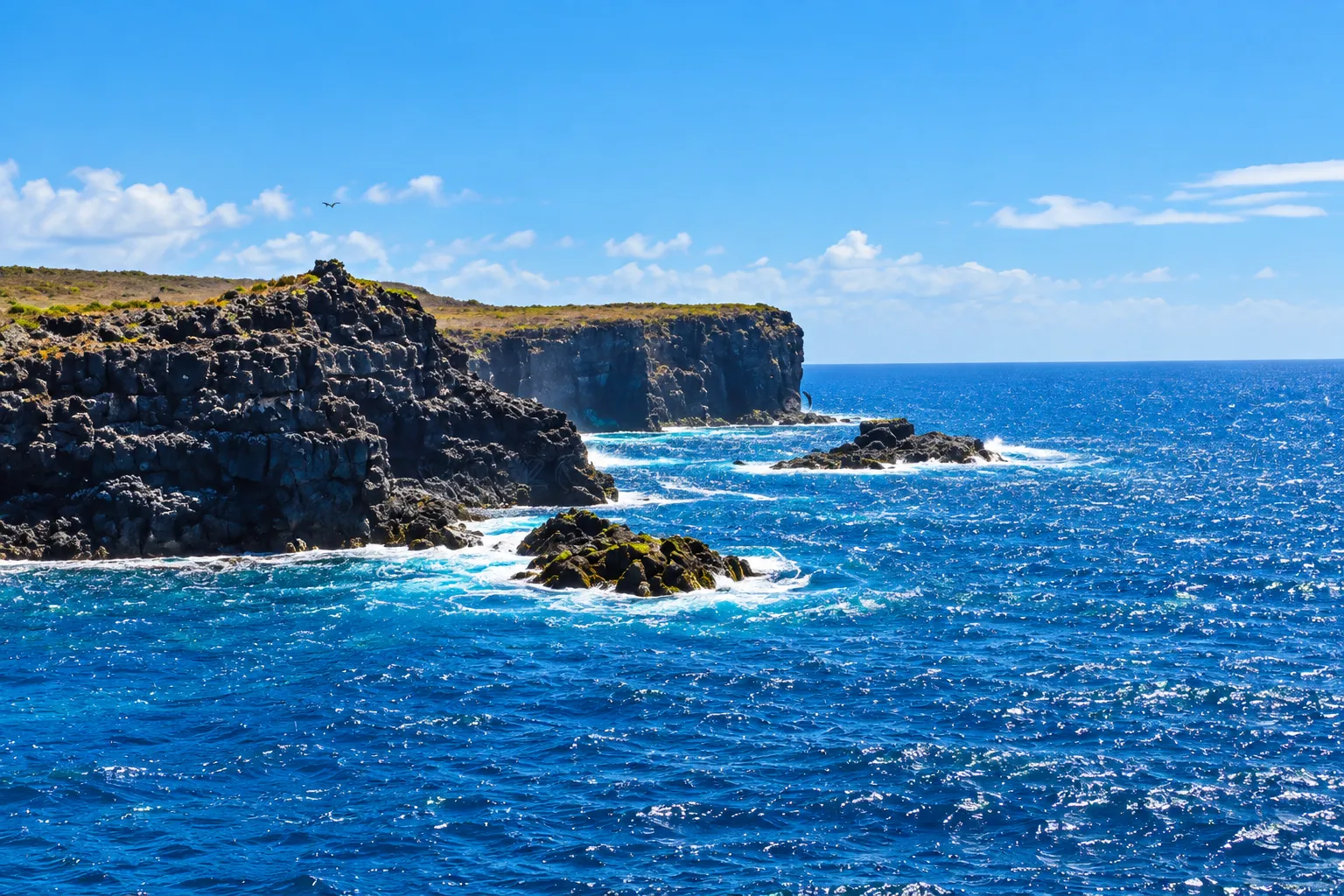
A circular trail then works along the shore, crosses a labyrinth of rounded volcanic rocks through arid vegetation, and reaches a plateau where the waved albatross uses the cliff edge as a takeoff point. The high coast offers panoramic overlooks over the sea and the Soplador, where waves shoot water skyward through a fissure in the lava. On the descent, the nesting areas of Nazca boobies and blue-footed boobies accompany the return to the lighthouse.
The west end of an ancient island
Punta Suárez occupies the west end of Española island, one of the oldest islands in the Galápagos archipelago. Its landscape comes from an extinct volcano that erosion wore down over time, and that origin can be felt in every scene of the walk: the bare rock of the landing, the rounded shapes of the interior, and the abrupt edge of the coast.
The landing by the lighthouse
The visit begins with a dry landing on dark lava rock, at the foot of a small lighthouse. On the stones, Sally Lightfoot crabs move among the crevices in their bright colours, and nearby sea lions rest stretched out in the sun. It is a simple arrival and, at the same time, a first sample of the life that inhabits the point.
The shore and its residents
The first stretch of the trail runs along the shore. There, sea lions, Zalophus wollebaeki, rest on a small sandy beach, and crabs cover the rocks of the surf zone. On the lava, marine iguanas, Amblyrhynchus cristatus, the species endemic to Galápagos, bask in the sun: on Española they often show reddish and green tones, and for that colour they are popularly called Christmas iguanas.
Watched calmly from the trail, the scenes of the shore repeat themselves with variations: a sea lion stretching, an iguana moving along unhurried, a crab raising its claws. Looking without interrupting lets each animal carry on with its own business.
Essential information
- Identity
- Punta Suárez, visitor site at the west end of Española island
- Location
- West end of Española
- Landing
- Dry landing on dark lava rock beside a small lighthouse
- Lighthouse
- Small lighthouse, start and end point of the circuit
- Sea lion
- Galápagos sea lion (Zalophus wollebaeki), resting along the shore
- Marine iguana
- Marine iguana (Amblyrhynchus cristatus), endemic to Galápagos; on Española it shows reddish and green tones
- Trail
- Circular circuit: shore, rock labyrinth, plateau, and high coast with overlooks
- Interior birds
- Rounded volcanic rocks through arid vegetation, with lava lizards, Española mockingbirds, finches, doves, and the Galápagos hawk as a possibility
- Plateau and albatross
- Plateau by the cliff edge, where the waved albatross colony uses the rim as a takeoff point
- Cliffs
- High coast with panoramic overlooks, with swallow-tailed gulls and tropicbirds as a possibility
- Soplador
- Fissure in the lava through which waves shoot water skyward
- Boobies
- Nesting areas of Nazca boobies and blue-footed boobies beside the descent trail
- Conduct
- Stay on the trail, watch your step beside the nests, keep distance from the cliff edges, and do not feed or approach the animals
The rock labyrinth
Past the shore, the trail enters a labyrinth of rounded volcanic rocks, polished by time, among the low vegetation of the arid zone. In that interior, lava lizards, Española mockingbirds, Darwin finches, and Galápagos doves may appear, and, crossing over the landscape, the Galápagos hawk. Each rock resembling the last turns the stretch into a small exercise of attention: the eye learns to tell the stone apart from the life camouflaged within it.
The albatross plateau
The labyrinth opens onto a plateau that ends at the cliff edge. Española is a breeding area for the waved albatross, and at this point the colony uses that rim as its takeoff point: from there, with the wind behind them, the birds head out to sea. Walking the plateau means moving inside the territory where that bird returns to breed, and the landscape is experienced with that awareness.
The cliff edge also marks the limit of the walk. The plateau is crossed calmly, looking inward and out to sea, and without going closer to the rim than the trail allows, so that the colony keeps that calm point of departure.
The high coast
From the plateau, the trail continues along a high coast, with panoramic overlooks over the open sea. On the cliffs, swallow-tailed gulls and red-billed tropicbirds can be seen, and the Galápagos hawk sometimes appears in the sky. Each overlook opens a different view of the same ocean, and the landscape carries itself: the rock, the wind, and the spray are enough to fill the eye.
The Soplador
On one of those sea-facing fronts is the Soplador: a fissure in the lava through which waves shoot water skyward, a spectacle of wave and wind that changes with every tide.
Each wave makes its own version of the Soplador: sometimes the water rises with force and sound, sometimes only foam peeks out among the rock. Watching it patiently, from a safe place on the trail, is part of the visit.
The descent among nests
The return descends past nesting areas of Nazca boobies and blue-footed boobies, with the nests only a few steps from the path. That is why it is worth watching your step and following the trail mark closely. The circuit ends back by the lighthouse, where the morning's landing becomes a farewell.
A visit inside the protected area
Punta Suárez is part of the Galápagos protected area. Staying on the trail, watching your step where nests may lie beside the path, keeping distance from the cliff edges, not feeding or approaching the animals, not touching or pulling up plants, and leaving no waste is the expected conduct, so that the place keeps the life that sets it apart.
Frequently asked questions
- A visitor site at the west end of Española island, with a dry landing by a small lighthouse, a shore with sea lions, a rock labyrinth, an albatross plateau on the cliff, and a high coast with the Soplador.
- By sea, with a dry landing on dark lava rock at the foot of the lighthouse.
- It is a circuit: first the shore, then a labyrinth of rounded rocks through arid vegetation, then the plateau that ends at the cliff edge and, at the end, the high coast with its overlooks and the return to the lighthouse.
- The waved albatross, a bird that uses Española as a breeding area; at this point, the colony takes advantage of the cliff rim as its takeoff point toward the sea.
- A fissure in the lava on the high coast through which waves shoot water skyward; the effect changes with every wave and with the wind.
- As a possibility: sea lions, marine iguanas, Sally Lightfoot crabs, lava lizards, Española mockingbirds, Darwin finches, Galápagos doves, Galápagos hawks, swallow-tailed gulls, tropicbirds, and Nazca and blue-footed boobies.
- It is the species endemic to Galápagos, and on this island it often shows reddish and green tones; for that look it is popularly called the Christmas iguana.
- By staying on the trail, watching your step where nests may lie beside the path, keeping distance from the cliff edges, and not feeding or approaching the animals.